K2inCanada's Blog

November 8, 2019

Road Trip – Rivers, Creeks & Lakes

Filed under: Animals, Bears, Canada, Hike, Travel — K2 in Canada @ 11:27 PM

Oct 19/20 – Time to take the new car for a drive. This wasn’t the first for this fall but the first with the new car. Usually all our travels are point to point to do stuff. This time we just had a potential route in mind but no real destination or things to do along the way (this was a first for us). The weather forecast wasn’t great with rain and wind for the coast. We decided to head up Hwy 99 through Whistler, Pemberton and Lillooet and then think about finding a place somewhere between Lillooet and Hat Creek or maybe make it to Clinton. And on Sunday head back on Hwy 1 through the Fraser Canyon. We packed tent, sleeping bags and firewood to be able to just crash anywhere but secretly I was thinking we probably end up in a motel. The car fit all the stuff we needed, including a big box full of fishing gear in case we would stop in on the way back on Sunday. So much about our plan.

We didn’t get started all that early since we went to order winter tires first. We hit the road around 10:30AM. It was raining lightly when we left but as we drove past Horseshoe Bay the rain had stopped. By the time we hit Squamish there were a few sections of blue sky. Diamond Head looked just beautiful but that wasn’t on the list for the day. And the sun didn’t really stay either. We did make our first stop before we even got to Whistler though.  Brandywine Falls, it’s only a short walk but the falls and views over Daisy Lake are worth the stop. And we got to see a couple Pika but they were very shy.

We continued on through Whistler towards Pemberton to have lunch. But even before we got there, we made another stop. Nairn Falls. Neither Jeff nor I had ever been there. It’s an easy walk to the falls, although longer than Brandywine (3km return) right along the Green River through the forest. Fall was in full force – a few nice colourful deciduous trees and tons of mushrooms. From tiny to large and I must have taken a picture of every single one on the way out. It was fun. The falls themselves are quite spectacular as well. Not as tall as Brandywine but just as powerful raging down over a couple drops through a tight little canyon. There are a couple viewing platforms but I would have loved to explore beyond those. Unfortunately, since we only expected a walk, we didn’t put on any good shoes and sandals are no good for scrambling in the forest. Nevertheless it was a beautiful walk.

Click here to hear the falls roar

By the time we got to Pemberton it was already 3PM and way past lunch time. So we had an early dinner instead. Unfortunately our little cafe we had in mind was closed due to some Hallmark Christmas filming going on in town. But we found another nice place to eat at but it took quite a bit of time. Hence we didn’t start on the part I had been looking forward to the most, the Duffy Lake Road, until 4PM. On top of that the weather had deteriorated and clouds had finally caught up with us from the coast. As we gained elevation leaving Pemberton, the clouds got closer and closer to the road. No views whatsoever and near the top it actually started to snow on us. We missed out on all the big mountain views I had hoped for (one more reason to come back here soon) but we did get lucky as the snow stopped by the time we started to follow Cayoosh Creek on the east side of Duffy Lake. We pulled off on the first little rec side we could find, Roger Creek, to have a closer look at beautiful Cayoosh Creek. And we decided to stay there for the night. We explored the campsite for a bit and spent a couple of hours around the campfire – good thing we brought plenty of wood. The clouds started to disappear and we could see stars sparkling through above us from time to time. Magical. To my surprise, we weren’t the only ones staying the night. But the site were far enough apart that we neither saw nor heard much of them.

I expected it to rain over night but it stayed dry. We didn’t quite wake up to sunshine but the clouds had moved up quite a bit higher and we could see mountain tops. The headache that had plagued me the day before was finally gone and I enjoyed the drive even more. The fall colours seemed a lot more vibrant that day. We stopped at a few more places along Cayoosh Creek. There were quite a lot of small rec sites that are probably packed all summer long but were almost deserted right now. The new car felt great on the windy road and the drive was just as much fun as the scenery was spectacular – until we almost hit a bear! Neither Jeff nor I expected bears to still be around but there he was, walking up the highway, hardly noticing that he had almost been run over by an Audi A4 Allroad. We turned the car around and found a spot to pull over hoping to see the bear vanish into the bushes. But he didn’t. 3 more cars had to slow down and drive around him. He kept walking up the road right towards where we were parked. We had stayed in the car to not spook the bear unnecessarily and so he walked right by the car. I mean right by the car. The right thing probably would have been to honk or make noise but with the engine off nothing works on those modern cars. And instead of continuing up the road the bear decided to check out the car. Looked over the hood and came around to the other side. I am sure he would have tried to poke the car but Jeff finally started up the engine which cause him to run off – not far, just across the road where he started to continue walking up the road. I could not believe it. This was not normal bear behaviour as I have experienced before and I have had my share of bear encounters. I wasn’t nervous for us but for the bear. He was too used to humans and cars, maybe he even was fed out of a car before, to not be a danger to himself and others. Eventually he walked off the road ahead of us. At least I think he did. We made sure to take off to not give him the opportunity to come back for a second look. In hindsight I know it was wrong to stop but we were quite far away when we did and based on previous encounters gave him plenty of space to avoid us. But then it is fall and bears are getting ready for hibernation. Maybe he was just desperate to find some food … we did have some bread and muffins in the car which he could have smelled. Still feel guilty about having alter a bears behaviour by being there.

Hwy bear video

A bit rattled by the encounter we continued on. We stopped at Cayoosh Point to take in the views of the creek way below us and the mountains around us, spectacular to say the least, before dropping down into Lillooet to have breakfast. Not sure why but for me going out for breakfast is the highlight of all our road trips :-). Here we had to make a decision. Continue going north on Hwy 99 to Hat Creek or head south along the Fraser on Hwy 12. We picked the latter, not only because it was the shorter route but also because it was a new route for us. And the drive was really nice, overlooking the Fraser the whole way but with more picture stops than the canyon drive on Hwy 1. At some point the hwy narrowed to a one lane road for a couple hundred meters right along a cliff. There were a lot of rocks on the windy section of road. Pretty cool. We also found a little made up gold rush camp. And instead of signs telling you to stay out they had a sign inviting you to enjoy it just not destroy it. There were faces all over the trees watching you – very cute. Thanks Dave & Bev whoever you are.

Experience the drive on Hwy #12

Eventually we made it to Lytton and I would have loved to extend the trip forever but it was time to head home. So instead of going north up the Thompson – towards the blue sky – we headed south along the Fraser – into the rain. And rain it did heavily for a while. Lucky for us, it lessened around Boston Bar and I convinced Jeff to do a small detour. We crossed the Fraser to explore Nahatlatch Provincial Park, taking the new car onto dirt road :-). For years we have been driving by here on our way to the Cariboo and I always wanted to explore Nahatlatch but there never was time. Now we made time. It may not have been the nicest weather for taking pictures but it was well worth it. Car handled the wet dirt road without a problem – sure the quattro helped. Mind you, we were the only “luxury” car on that road. Everyone else was in trucks or SUVs. The drive to the actual park took a bit longer than I thought but definitely a nice area. Once in the park there are quite a few rec sites along the lakes and we stopped at a few to soak in the beautiful views despite the clouds. At the last stop we decided to have lunch, overlooking Nahatlatch Lake, hiding from the light rain under some large trees. Piece and Quiet!  I loved it. Definitely on the list to explore more in the future – but that list is getting pretty long :-).

This pretty much marked the end of the trip. The drive back Hwy 1 was uneventful and wet. A much enjoyable fall road trip in the new car – I see more to come… Although this was not our first fall trip this October.

May 29, 2019

From Hot to Cold – April

Filed under: Animals, Bike, Canada, Kayak, Racing — K2 in Canada @ 10:29 PM

In April, we paid for all the warm weather we had in March. Temperatures dropped below seasonal for most of the month of April – at least that’s what it felt like. It also was a bit wetter than May but still not too terrible. Most of our adventures were related to paddling that month, but for one bike ride.

April is the start to the TNR season. It started off with a nice evening on Apr 2 but it got consecutively colder each week. Mind you at least the rain stayed away from Tuesday evenings for the most part . The cold wind was just not nice after getting off the water all wet. Below a few selected pictures.

We spent half of the weekends paddling in Indian Arm. It was mostly hard work and long paddles. And it was cold and wet! Except for the last day of March where we happen to see a river otter play on the rocks. Very cool!

Couple weekends we actually raced.  A new one for us – D’Arcy Island Cash Dash on Vancouver Island near Sidney on Easter Saturday and an oldie we haven’t done in a long time, the Dan Harris in Bellingham, Washington, on Apr 28. Yep another trip into the US! Both of those days were incredibly sunny and mostly calm but what little wind there was was freezing cold!

The D’Arcy Island race didn’t go that well for us. Somehow we got out of sink in the 2nd half and were fair and square beat by Kathleen and Gareth as well as a couple single surfskis. But it was overall a nice event!  And there were cash prizes as well as long as there were at least 3 boats in a class. Unfortunately there were only 2 doubles. Hopefully next year there will be a few more boats from the mainland out. Majority of the paddlers were OCs since it was a Cora race.

The Dan Harris Challenge went a bit better. Lots of doubles and we came in 4th double overall. There was some tough racing going on. Overall Team Canada did quite well in this first leg of the Think International Surfski Challenge even though we did get beat by the US. The margin was the smallest in years though. And Team Canada actually won at the end because they did better in the Canadian race, the Board the Fjord Race in Deep Cove in early May. Jeff and I missed that one though – May is fishing season (for another post).

The first bike ride of the year (other than the daily commute to work that is) up Mount Fromme happened on Apr 27. We meant to go up all the way to the top of Grouse to see the bears but the snow stopped us. So we had to settle with seeing a male Blue Grouse. He tried his hardest to win my heart – dancing and cooing :-). Pretty darn cool! I used my new e-bike for this ride and it was a breeze to get up. Now Jeff is the one trailing behind – which gave me the time to flirt with the grouse. I get the feeling he might be regretting talking me into this new toy :-).

If you want to see more of my friend the Blue Grouse, check out this video:

Last but not least, a few odds and ends pictures from spending weekends mostly at home in April.

May 8, 2019

March Magic

Filed under: Animals, Canada, Ski, Travel, Yukon — K2 in Canada @ 10:56 PM

One more time back to March. Sorry, it took a long time to finish this!

Mar 23 was the day of the Buckwheat Loppet, a new loppet for us this year since we missed out on the Birkie in Edmonton due to the extreme cold in Feb (-31C). The Buckwheat is being organized by the Skagway Nordic Club in Alaska, is being held in Northern BC near Chilkoot Pass and the majority of the attendees are driving in from Whitehorse, Yukon Territories. I would have been really looking forward to this event but my right knee had flared up yet again the week after the Sun Peaks Loppet and I was on pain killers for 3 days. I was just starting to feel better the Thursday before the race but far from perfect. Anyhow, I figures I’d be in good enough shape to ski if not race.

We had our flight to Whitehorse booked for 8:30AM Friday morning. I was still in the bathroom trying to wake myself up with a splash of cold water in the face at 6:30AM when I heard Jeff laugh out loud from the living room. What now? All he said was, check your email. And there it was, the Buckwheat Loppet was canceled due to melting snow conditions. It has not only been above seasonal warm in Vancouver obviously. The email said it was unsafe to put in their usual 25km course but that they would still have a 10km loop ready to be skied on and all the festivities would still be happening. Just no timing. One could ski as long as one wanted and then stop in for a burger at the ice castle. The Buckwheat always has a theme for people to dress up – this year it was Alice in Wonderland. We could have tried to cancel the flight, hotel and car but I figured why not go and check it out anyhow. May still be a fun weekend, even without a race (secretly I was relieved to not have to race on my weak knee). I figured there are plenty of things to do in Whitehorse when it is +10C vs -31C in Edmonton.

And so we were off to the airport shortly after. Fate almost struck again. As we were waiting to board the plane they called for volunteers to stay behind as they had overbooked the flight. 2nd chance to stay home? Nope, I was now intend on going – get out of town for 3 days. It actually is a less than 2hr flight to Whitehorse which makes the total travel time about the same or less as our usual winter getaways by car into the interior and by far more relaxing. Beautiful views along the way for the most part. Once in Whitehorse we had to wait in line for the rental car company since half the plane had rented from the same outfit. But eventually it was our turn and the friendly guy behind the desk tried to save us money by talking us out of paying extra for unlimited kms. But we did the math and knew we would easily be over the limit since it is about 180km one way from Whitehorse Yukon via Chilkoot Pass to Skagway Alaska. Daily limit was 300km. So we finally got the key to the rental car which was supposed to be just in the lot outside. But we looked everywhere, there was no grey Ford Fusion. Hitting the panic button also resulted in complete silence. The poor guy behind the counter was a bit flustered but that had us end up with a bigger car than we had originally paid for for no extra charge, a black Toyota Corolla. Ironically this car had winter tires on while the car we rented in Ottawa just after the biggest snow storm in a long time had none. We were able to check into out hotel early. It was situated in downtown right across the road from the mighty Yukon River. It wasn’t the most luxurious place and the neighbourhood looked a bit sketchy but it was clean and in walking distance of food and beer! We had a late lunch/breakfast at Tonimoes, as suggested by the car rental guy, just a couple blocks away. The food was good, the beer even better and the server very friendly and chatty. We were the only customers.

It was a beautiful sunny and warm day in town and we decided to take a drive up to Chilkoot Pass and take in the sights along the way since we would not have the time in the morning of the race to stop for pictures. And what a drive it was – incredible scenery all the way. I let the pictures below tell the story. We stopped in at Carcross to hike the desert. Carcross Desert isn’t a real desert but a pretty sizable windblow from the glacial sediment collecting along the shores of Bennett Lake. It was warm enough for T-shirt and the shoes came right off as well. I never expected it to be this warm in the Yukon in March – +13C. I sure fell in love with the place. We made it to the “Log Cabin” Provincial Park where the non-race would be hosted the other day. There seemed to be enough snow still to ski, even though it was a bit soft. We saw a couple of skiers come off the trail and they confirmed the 10km loop should be in good shape. We again took our time driving back, stopping again in Carcross to explore the shores of Bennett Lake as the sun was playing with some clouds. The view was absolutely stunning.

Back in Whitehorse we decided to just go back to Tonimoes for dinner but for some unexplained reason they were closed at 7pm on a Friday night. We kept wandering around the downtown area and looking for another place to eat and ended up at “The Burned Toast Cafe“. It sounded more like a breakfast place but they were open for dinner. And we really lucked out here. The food was very good and way above your normal pub food. They used a lot of local stuff. We had Wild Game Potato Skins filled with elk salami and bison pepperoni as appetizers and I followed it up with locally made Elk and Blueberry Sausage. Yummy!!! We had planned to go and see if we can be so lucky to watch the Aurora Borealis that night and the super friendly server told us about THE place to go to. “Just past Kopper King, you know” Well, we did not know where or what Kopper King was/is but I could find Fish Lake Road on my tourist map. “Just 10km up a good gravel road a couple kilometers out of town”. We were able to find the turn off and drove for quite a while. Jeff was ready to stop after 3 km at a lookout over Whitehorse but I insisted to continue. No way it was dark enough there. Jeff was grumbling about it but we drove on and eventually made it to Fish Lake. It was the perfect place for watching the Aurora – if there was one happening. We waited for a good 90min for the show to start. It didn’t. There was a bit of high cloud cover around as well and we figured that might be the reason we saw nothing but darkness ( it wasn’t). Still it was a cool place to be – so quiet and peaceful and not at all that cold either. But we were late to get to bed – past midnight which hasn’t happened in a LONG time.

It was a bit of a noisy night and 6:30AM came way to early. Non-Race Day – we had to be at the start line by 9:30AM. It was a pretty nice morning and the drive in the early morning light was just as beautiful as the day before. I was sooo sure we would see a moose on the drive but nothing. No deer, either. Nothing! We made it up to the Log Cabin PP with plenty of time to spare. But as the start time came near the parking lot was still fairly empty. Maybe most people decided to stay home? Not so, we were an hour EARLY!!! Apparently the race start time was on Alaskan time, even though we were still in BC, and Alaska is an hour behind BC. I could have slept for another hour?! Oh well, it was not a bad day and we had a bit of a walk and admired all the costume of the people getting ready for the ski. Most of the participants had a costume. From Grinsekatze = Cheshire Cat to card soldiers and nasty queen, everyone and some were showing up. Very cool. I felt out of place in my “race” suit even though it’s a perfect costume for me.  Eventually we got near the start time. They still had staggered start times by 15min for the 50km (which Jeff had signed up for) and 25km (which I had signed up for) and the 10km even though there was no race. Jeff start did have a few young guys line up, all in race suits and Jeff realized there may still be someone to race with. And off they go… racing :-). My start, 15min later, was a lot more civilized and almost everyone wore a costume. Initially the trails were in decent shape but fairly narrow. It was flat. I was going fine mid pack. But it did not take long until we hit the first obstacle. We literally hit a wall of sticks sticking out of the trail right in the middle of a short steep section with a 90degree turn at the bottom that looked like trouble. I stopped dead, bit the snow and off course my bad knee did not like that one bit. While I tried to get onto my feet again, I saw a few skiers almost kiss the tree at the 90degree turn below hardly making the corner. No way I could do that on my bad knee. I waited until most people passed me and then actually took my skis off to walk down. I sunk in up to my hips – so much about not enough snow. It was NOT fun. The trail continued to be challenging. If I had been in better physical or psychological conditions, meaning not afraid of hurting my knee yet again, this could have been a fun course but it was narrow with some really steep, although short turny and twisty downhills. Mind you it never seemed to go up ever. I was terrified by the time I made it to the ice castle for the first time, about 4km into the “race”. But the ice castle was cool – the shape of a big grinning cat big enough to walk into – and I was able to take a deep breath and get myself together again. If they can build an ice sculpture like this for us I can finish this damn ski! So I continued on thinking I want to at least finish the 10km. I did end up walking a few more hills even though the first one was the worst. On top of all that, it started to drizzle a bit but I hardly noticed that and it did not last all that long. The last stretch had a lot of debris on the trail and I put another nice gash into my base. Overall the skins worked fine though.  Jeff passed me while I was still on my first lap. It was tough skiing for me and I can’t really say I enjoyed it but I managed to almost finish a 2nd lap secretly hoping Jeff would happen to catch up again when I was near the ice castle – you get to see it three times during the 10km loop actually – but he did not catch me until after I passed the ice castle for the last time with about 2-3kms to go. He also thought conditions were tricky but of course he raced on, intend on finishing his 50km. He was on his last lap. So we decided to meet up at the ice castle. In stead of doing another full 10km I decided to just turn around which was a bit tricky on the narrow trail with lots of people coming towards me. But I made it back to the castle, nobody complained about me going the wrong way, everyone smiled. Luckily the drizzle had stopped. There were tons of people at the ice castle and many amazing costumes to look at. The ice castle had more carvings in it than I originally saw – absolutely amazing! And they had the BBQ going as well – how they got all this to this place in the middle of the ski trail system is a mystery to me. Pretty committed volunteers, almost puts all of our local races to shame. Although I always admire all and every volunteers out there in the freezing cold waiting for the slow skiers like me to finish. Here nobody waited, everyone was partying since the ice castle was also the food station. Once Jeff finally finished, we quickly grabbed a burger and then skied back the last 3km to the car without any further incident.

We decided to drive down into Skagway for the actual apres-ski party which was supposed to be amazing. Not sure though how anything could beat the ice castle thing. It did not take long until we hit the Canadian customs booth but then there was no US booth anywhere near it. We continued on driving through the high mountain pass. It was raining again and visibility was about 5m when we drove into the low hanging clouds. All of a sudden, Jeff hit the breaks complaining why they would reduce the speed from 90 to 40 without a warning. Then it dawned on us – that sign was in miles/hr. We were no longer in Canada. Somewhere in the clouds we must have crossed the border. We still had not seen a US customs booth. It probably took another 10min already going down towards the coast until we finally reached US customs. Off course I had to go in to get my Visa and it took quite some time. Not because of me getting the visa but because all the custom officers, all 2 of them, were busy checking the many cars coming down from the ski race :-).  Getting the actual visa was painless. We finally made it into Skagway. It was overcast and windy and pretty much deserted. We had a quick look at the ocean but it just look uninviting. The town lives by the cruise ships that stop here all summer long. In March there aren’t many people around but everything looked in very good shape. The “downtown” area was kinda neat with it’s “gold rush” style architecture. It turned out that the apres-ski party wouldn’t start for a couple more hours. Too late for Jeff and I who had to drive the 2hrs back to Whitehorse that evening and neither of us was looking forward to drive the foggy pass in the dark with dropping temperatures turning the wet road to a sheet of ice. Hence we ended up in the only open pub, a local brewhouse and had some beer and food. Both were very good. Next time we plan a bit better and stay the night.

The drive back was actually much nicer than expected. The clouds had cleared up and we had some beautiful views over the white emptiness along the pass. That’s the reason both border stations are so far apart from each other – the area is so remote it was too expensive to get power up there. So if you ever want to set your foot on US soil without having to go though border control – knock yourself out at Chilkoot pass :-).

Back in town we had a quick rest and then drove out to the Takhini Hot Springs about 10min out of town. These hot springs aren’t huge or luxurious but they also were not busy at all and are nice and warm. It was awesome, exactly what we needed, and we soaked our sore bodies for quite some time. Last stop for the day was Lake Laberge to see the apparently even stronger Aurora that evening, sometime within 3 hours of midnight – or so we were told. We stopped at a gas bar to pick up some chips and beers for our evening on the Lake. The drive to the Lake Laberge campsite took some time but we were the first ones there – other than a family camping. It was so quiet and dark – until someone crossed the still frozen lake in their ATV. Then again it turned quiet and peaceful. Stars started to come out – a million stars. Wow! The sky was almost white with stars. Then more people showed up and it got “noisy” again. We stuck it out till about 11:30PM. No hint of an Aurora yet but we were both too tired to stay any longer. As we left there, we saw at least 3 actual tour busses coming down the road to the lake. But at that time I wasn’t sad we would miss it. I wasn’t looking forward to experience it with all those noisy people around. Funny how quickly the Far North makes you feel 3 people are a crowd :-). Anyhow, turned out we missed nothing. But we had a great night sleep.

Day 3 of our mini trip. So far it had been just short of amazing and very relaxing (yesterdays anxiety attack during the ski long forgotten). Another blue bird day and still not too cold. We had 45min to kill before The Burnt Toast Cafe would open for breakfast and hence did a walk along the mighty Yukon River. Not much was left of the ice that had still covered the river only 2 days ago. Amazing how quickly the snow and ice was disappearing everywhere. And off course we paid a visit to the SS Klondike Paddle-wheeler who was running the Yukon River from 1929 to 1955 between Whitehorse and Dawson City. We paddled that stretch many years ago in a double sea kayak as participants of the Yukon Quest Race – 740km in length. The race still runs every year….but we never had the ambitions to do it again.

We made it to the cafe just in time before the crowds and got a window seat. Apparently this is a popular place with the locals. Breakfast did not disappoint. More awesome sausages for me and pulled pork hash for Jeff. No wonder they ran out of pulled pork for dinner the previous night, given the amount they serve for breakfast. The rest of the day before our flight out at 5pm was spent at the Yukon Wildlife Preserve near Takhini Hot Springs. You can visit the park by foot or bike or buss. Obviously we decided to walk. It’s quite a big park and sometimes animals are far away but it was fantastic! From deer to moose to sheep to goat to caribou to muskox. All my favourite hoofed animals were there. The two moose of course were the highlight – we got so close. Unfortunately the friendly park people had specifically warned us about NOT touching or feeding the moose and it took all my willpower not to. As for all fenced in animals, the grass always looks greener on the other side. Except, these two moose were not trying to get at the grass but the small still leave-less bushes along the fence. Pretty tough diet if you ask me but they moved the whole fence around to get at it. The predators of the North were not quite as well represented – all for the better since they are always kept in too small of an area. So no bears or wolf but they did have foxes and a couple of lynx. The lynx were circling their habitat for quite a while seemingly looking for a way out which made me a bit sad but also offered quite nice views of the animals themselves and we got to see them quite close. It’s not quite the same as seeing these animals in the wild but this park did a great job in trying to provide enough space for the animals to roam. We spent many hours walking the ~5km trails system of the park and I took many pictures of course, until my battery died :-). Time to go home, sigh!

A most magical trip – amazing, scary, fun & relaxing at at the same time! For a week or two after Jeff and I looked into buying a property up there. I am sure the weather may not always be this cooperative, especially in March :-).

P1030976 (Medium)

Takhini River

February 9, 2019

Drive – ski – eat – sleep – repeat = Christmas break

Filed under: Animals, BC Ski Trip 2018, Canada, Ski — K2 in Canada @ 9:14 PM

I realized I never did the 2017 trip report (yet). Anyhow, no reason not to do a quick one on the 2018 trip. Overall it was a shorter trip than usual since we spent Christmas in town rather than taking off on day one of being off work. So this years trip only saw us doing the half circuit. We only made it as far as Kimberly along the southern route and back. But we added a new twist stopping in at Nelson for a day to go skiing with Jeff’s brother for a day or maybe two. He just started skiing … but here is the day by day report.

Trip Map

MapMarked (Medium)

Day 1 (Dec 26): The first day was a driving only day. We didn’t rush it in the morning and hence there wasn’t much time left to ski Manning on the way to Keremeos. Instead we arrived with some daylight left and went for an evening stroll in Keremeos along the river which was quite nice actually. We stopped in at the Branding Iron for dinner on the way back to the motel. Good hearty meal! We stayed at the Alpine Motel this time because nobody was at the reception at the Elk Motel and it turned out it was a nice choice. I think we will stay there again.

Day 2 (Dec 27): We woke up to a mix of sun and clouds and not too terribly cold temperatures. Drove up to Nickel Plate seeing the wild horses at the turnoff to Green Mountain Rd. It was overcast at Nickel Plate when we started. I decided to skate first that day and even though it was hard, I made it around the old loppet course once. Switched to my skins for a 2nd loop but cut out meadows and Vindicator. So all in all just about 22km which wasn’t much but I had enough and time was up. We had a relatively long drive ahead of us all the way to Grand Forks. I think the drive was uneventful but long. More rainy wet than snowy and no deer, for the very first time, in Midway. When we arrived in Grand Forks we found out that our trusted $50 Motel on the River was gone – we learnt later that it fell victim to a bad flood in the area. Which was really too bad since the next best thing was expensive and awful even though we were told it was just renovated – don’t ever stay at the Imperial Motel at the east end of town! But food and beer at Clyde’s Pub was good and saved the evening!

Day 3 (Dec 28): What really made the stay in Grand Fork worthwhile though this time was the “Wooden Spoon” – a local bistro/cafe serving an incredible selection of breakfast choices made from fresh local food. Absolutely worth it. The spicy pulled pork bennys and pancakes with rhubarb sauce were to die for. Jeff and I each had half. They also make a really good London Fog!

Loaded up with way too much food in our tummies we headed to Paulson near Nancy Green Park – one of our favourite places to ski. This time we met up with Jeff’s brother Brent who had just started cross country skiing a couple weeks ago. Mind you he has done a lot of downhill and back country skiing. His longest skinny ski outing was 7km. We took him on our usual route totaling 26km. His technique was already pretty good for the short amount of time he had been skiing and he set a comfortable tempo for me. Of course Jeff was yoyo-ing back a forth :-). I figured we may actually turn around at Glenmerry cabin but with the best part still to come, single track on Norwegian, Brent did not want to miss out. Obviously he was tiring fast but never complained till the bitter end, 3hr and 50min of skiing with only one short 10min rest! All in all a great ski despite the mostly overcast skies and some flurries this time.


The drive down into Castlegar was a bit hairy though. Both Brent’s and out car did a little slide out but both recovered without incident. This was definitely the worst stretch of road. We made it in one piece though. His girl friend Sheila was waiting for us and we had a wonderful Lasagna for dinner and plenty of beer. Brent was getting more and more sore by the minute :-). We stayed in their newly done up guest room and managed to destroy the bed. The frame broke underneath us – no we did not have wild sex! I hardly moved when it happened. Ooops. Anyhow, we didn’t want o wake anyone upstairs so we just took the mattress into the next room and slept there. Sheila told us the next morning that they heard the noise but thought it would have been the shower curtain. We had a good laugh together looking at the collapsed frame. Brent thinks he can repair it.

Day 4 (Dec 29): After a good hearty breakfast we took off for a ski at the Nelson Ski Club, on our own. Brent decided to take a rest day and I can’t blame him. He told us about a short cut to get to the highway but we missed it and ended up climbing high into the mountains until we got stuck! It was quite snowy in Nelson. Luckily we were on a hill and just needed to roll back to turn around. We made it to the ski area without further hiccups. The club is right in the valley with beautiful trails along it. Not much climbing and what little climbing I did felt hard! I never felt this tired on our ski trips before. The weather was also a bit on the cold side with light snow blowing across the open areas. While I stayed on the west side of the highway in the valley, Jeff went across and did some of the eastern trails which he said were very nice but busy. We have to come back though to explore this area more and hopefully get some sun too. Not sure though Brent and Sheila will have us again after destroying their place … I think we also managed to almost kill the bathroom fan…

Another long afternoon of driving and we made it to Cranbrook well past dark. At least here, our usual Flamingo Motel was still there and they had room for us. We decided to drive into town for dinner rather than walk. We had dinner at Deweys Pub & Grill but I can’t remember what we had. It was good though. We did a bit of a walk through town. It was a bit drizzly. This was the first trip I remember were we saw actual rain!

Day 5 (Dec 30): We woke up to sunshine and after quick brekky in the room headed over to Kimberley. Jeff had a 50km double poling training ski planned for the day. I started out with skating again for 3 laps of the 6.5km loop and then switch to my skins to climb up Cardiac Arrest to the top of the hill with a beautiful view over the Columbia Valley below. It was slow and hard work but fun. Even the downhill. As always, the grooming was excellent. I tried some of the single track trails this time. They were much quieter than the main trails. It was a Sunday after all.

We had an even longer drive that day – all the way back to Grand Forks. Road conditions were okay but it was probably 5hrs in the car non-stop. And we sure did not wanted to stay in the Imperial again. So we found a motel further west along HW 3, The Western Traveler. Not that it was cheaper but the room was nicer and they had deer hanging out in the parking lot. We did get a scare though when we arrived. One of the tires on the car made a horrible screeching sound. Well it was close to 8PM and not much we could do but park it for the night. We would find a tire place in the morning. Luckily there was another pub not to far away we could walk to. The downtown area would have been quite a walk. All was good for the night.

Day 6 (Dec 31): The deer were still there in the morning when we got up. Unfortunately, the Wooden Spoon was closed and we only had a quick breakfast in the room. When we started driving the noise was gone but we still drove by a tire place to have it looked at. They guy right away said probably a rock in the breaks. He didn’t even take the tire off but showed us the scratch. Oh well, we were good to go. The noise did come back at some point but it also went away again.

P1240398 (Medium)

Today, Jeff had something special planned for us. Downhill skiing at Phoenix Mountain to give our cross country ski muscles a rest. I have NEVER downhill skied in my life. I tried snowboarding in 2002 but it never stuck. How hard can it be though!? Well, first off we had a long drive up a logging road to get to the mountain – it was well plowed though (apparently that was not the case every day). Secondly, the hill was still closed when we arrived at 10AM. It was New Years Eve and the hill operation started later that day. Lucky for us the staff had already arrived and let us sit inside the small lodge complex for an hour. Lastly they only had a T-Bar. But first we had to rent downhill skis – everything was half price for the day so it was really cheap. Phoenix Mountain is a community run mountain and not for profit. Ski boots are tough to get on though! I figure I will never get my food in there or once I did actually tighten the straps but with a lot off pushing and shuffling and Jeff’s help I made it. I wore all the clothes I had. It was a sunny day but it also was the coldest day we had, maybe -10C. And downhill skis are damn heavy. It was horrible to walk in those boots with the heavy skis in my hands, poles in the other, helmet on and bundled up like marshmallow man. Putting the skis onto my feet did not improve the situation by much. And Jeff did not want to go onto the bunny hill so that I could try those heavy, stubby things on my feet in a controlled environment first. By the way, the skis felt like they had NO glide whatsoever. So we headed up the hill, it’s only a small hill with a single green run, right away. Hence we had to get on the T-bar. Getting on was okay, I even made it up the hill without falling off but getting off the T-bar was not so graceful and yes, I took out the lift! The T-bar snatched the power cord after I fell off it way to late. Ooops. Apparently that isn’t too unusual and lucky for me I only did it once. Now I was on top of a mountain with beautiful views over the surrounding white landscape, beautiful sunshine, no wind and a tiny lodge way down below. How on earth am I going to get down? Jeff gave me instructions – snow plow, turn, ski across the mountain, repeat. The first part was nice and gentle and I though, now this isn’t too bad. But the the actual downhill started and it looked awfully steep. I was terrified and stiffened right up. I was ready to take my skis off and walk down when Jeff said I should stop whining and just go. “Stop looking down!” That actually helped. I made it down, not very graceful but I stayed on my feet for the most part. And we did it again and again. My legs were shaking by the end. Who knew downhill can be this hard :-). On the last trip down, I fell and twisted my good knee awkwardly. I managed to get down but the knee was pretty sore for the next few days. But I was glad we had come – I may even try this again :-). Turned out they even have a cross country ski area up there but there was no information about their grooming.

The drive to Princeton wasn’t quite as long after we made it down the mountain onto the highway. Back in Princeton we stayed at the usual Cedars Motel and ate at the Irish Pub. It was New Years Eve after all and the pub was getting ready for a big party. We got there early, before 6 but it was pretty much empty…and it was still nearly empty when we left. I hope they did get some partiers. As For Jeff and I, we fell asleep around 10pm 🙂

Day 7 (Jan 1): The first day of 2019 started out sunny and nice. After a good breakfast at The Ranch, we headed up to China Ridge for the last ski of the trip. It wasn’t too cold either – still single digits. They did not have a ton of snow. Early on there was some on the trail, we even had to get around a fallen tree and some, especially the steep downhill sections on Harkers were extremely icy (I walked those) but overall the trail system was in good shape. Animal tracks everywhere from deer to rabbit to coyote although we didn’t see any other than the deer in town on the drive up. Jeff and I skied together to the cabin at the end and back. A great day to end the trip. The drive home was uneventful.

October 15, 2018

More sun than fish

Filed under: Animals, Canada, Fishing — K2 in Canada @ 10:21 PM

What a beautiful sunny day on the river yesterday. The only thing I dislike is the getting up at 5:30AM. It started out a bit windy which made us fish the west side first so that we had the wind at out back. I would have been miserable trying to cast into a strong headwind. The water levels were extremely low. We did a lot of walking but didn’t get into any fish. Saw the sea otters again swimming and lots of eagles sitting in the trees getting ready for the salmon feast. And Jeff got into a sockeye of all salmon just as the wind died down.

So we crossed over to our usual side – via a bridge, not swimming. There was at least a bit more activity than we had seen all morning. But I could not touch a fish. Not even Goldies. Interestingly, I saw a lot of bees float by me. Tried to rescue the first but there were so many … floating downstream in the river and sitting on the beach “eating mud?”. Is that how a worker bees life ends – drown with a belly full of “rocks”? Jeff got into a spot with his buddy Gary and company and they seemed to be hooking fish but not many made it to the beach. Lots of Chum around. At least I didn’t see many caught as I fell asleep leaning against a big boulder on the shore in the sun for an hour – it was awesome :-). When I woke up again I did not want to crowd in the boys so I walked some ways up river and fished another of our usual spot for a while where there were fish showing. Again no luck but my casting is getting better and better. Right at the end of the day, Gary and company had long left, I saw Jeff finally land a nice clean Coho. And it was a hatchery one. I joined him for a bit and hooked into a couple Chum, the 2nd one took my fly. I had enough after 8 hrs on the river as the sun was about to disappear behind the hills. Jeff would have stayed till dark I am sure but I had beer and ribs at the Gilnetter Pub on my mind :-).


We had fresh BBQ salmon tonight – fabulous!

October 13, 2018

Glorious Fall Day – Hike & Paddle

Filed under: Animals, Canada, Hike, Kayak — K2 in Canada @ 10:00 PM

Beautiful blue bird day in Vancouver – after a full week of it as well. Didn’t see much of the sun during the week. It’s barely light when I ride into work and almost pitch dark when I left. Fall would be so much nice if the days would be longer. Anyhow, despite me expecting the rain to return for the weekend it didn’t. We don’t get many of these October days! In the morning Jeff wanted to roller ski up Seymour so I went for a short hike up to Brockton Point and back via Mystery Lake and down to Goldie Lake. Seymour was busy with people but I managed to sneak up on a couple grouse on the way to Mystery Lake.

In the afternoon I took my surfski out on the river. It was almost slack tide and I made it down to Arthur Laing Bridge and back going easy.

October 7, 2018

Flashback 2017: Meeting my parents half way

Filed under: Animals, Canada, Hike, Newfoundland&Labrador, Travel — K2 in Canada @ 2:01 PM

This post has taken me a long time, writing and picking pictures out of the thousand I have. But a few weekends at home and rain this fall finally made it possible.

Pre-Trip Notes:

2017 marked the year of Canada’s 150th birthday. It was also my 20th anniversary in this country. Last but not least, my parents picked that year to visit us again since it was their 50th wedding anniversary! This would probably be their last trip to Canada as the long travel time is getting to my mom. Unfortunately they are not getting any younger :-). So, I thought, why not meet them half way. They have been in BC many times before and I didn’t really know how to keep them entertained for 3+ weeks. Discovering a new Canadian province together seemed to be the right idea for all of us. Jeff and I always wanted to see the most eastern province. We had been to Nova Scotia before, for flat water racing in 2004 but we hardly saw anything else but Lake Banook. Hence the idea was born in January to visit Newfoundland & Labrador. 2 weeks over the July 1st weekend to celebrate Canada’s birthday at the other end of the country. Since both, us and my parents love camping, I decided to rent an RV rather than the usual Bed & Breakfast trip that this province is so famous for.  Getting the RV organized though was a bit of a nightmare. There is only ONE place in all of Newfoundland where you can rent RVs and availability was very limited. The 4hr time difference made it difficult to communicate by phone. When I woke up to call before work, they were on lunch break and when I had my lunch break the office was already closed. Island time. By the time we finally got to the booking stage, the unit I picked, 22ft, was already gone and I had to go to the next larger one, 25-28ft. But at least I had the most important thing organized. Since an RV is less mobile, we also purchased a couple cheap mountain bikes at Canadian Tire in St John’s for Jeff and I. The idea was that Jeff and I can still take off and explore while my parents rest. Canadian Tire does hold online purchases for up to two weeks which was petty convenient.  We just had to time it right and hope that the bikes we picked would be available. Worked out almost perfect, except I had to choose a one size smaller bike.

I didn’t find as much time as I would have liked to plan the trip properly. Just printed out some hikes and parks and a list of possible campsite in the different regions but that was it. All I knew was that I wanted to see the Vikings, hike Gros Morne and set my foot onto Labrador. My Dad actually came up with the idea for the first day, Cape St Mary’s, and the evening of the day we left I decided to book us a campsite for the first night in La Manche Provincial Park.

If you rather just look at hundreds of pictures than read the whole story, just click on these two links:

Parts 1: St John’s to L’Anse aux Meadow

Parts 2: Quirpon to St John’s

We left Vancouver for St. John’s, NL on the red eye flight at 11:20PM on Jun 23rd after still working all day and packing in the evening. I can’t remember why but our flight was almost an hour late leaving…

Day 1 – June 24, 2017

… and we only had 45min on our itinerary to switch planes in Montreal. There was a real chance that we would miss out connecting flight – not really how I expected to start off our trip.  Somehow the pilot did make up time in the air and we managed to be almost on time. But then it took another 15min until they let us off that damn plane. Jeff and I were sprinting through the airport for what felt like 30min! The two gates seemed to be at opposite ends and the airport in Montreal is pretty big. Some other passengers from our Vancouver flight who had to catch the same plane somehow managed to get a courtesy ride on one of those electrical terminal carts. When we passed them running, I knew we would be okay. Miraculously, and totally out of breath, we made it. And to my utter surprise so did our luggage which I had been worried about during the 4hr flight to St. John’s.

We arrived on time in St. John’s at just before noon. It was an overcast and a bit drizzly day. My parents wouldn’t arrive till 3PM from London, and our first task was to pick up the RV. The rental place actually offered a pickup service from the airport, which was very convenient, and we got the first taste of the friendliness of the Newfy people.  It wasn’t a long drive. It took a bit of time to get all the paperwork done and get a tour of the RV which, since I booked it, had grown yet another couple feet – to 31ft to be exact or 10m in length. It looked and was HUGE, and Jeff got a bit worried about how to drive this monster through rural Newfoundland. But he got the hang of it very quickly and did all the driving. Quite a luxury accommodation compared to all our other camping trips. It had a separate bed room – for my parents, a toilet – which my parents were very fond of, a shower – we never used other than to store beer, a kitchen with fridge and small freezer and dinner table – which we used every day, some extra seating for when driving – which my parents used, a bed on top of the driver cabin – which Jeff and I used, heat – which I thought we would not have to use but I was wrong, a big fresh water and separate waste water tanks – which we had to empty twice, strong batteries and a backup generator – which we had to use when, while not on external  power, we wanted to use the coffee maker or toaster, a big gas tanks – which we filled up almost every day. Pretty cool.

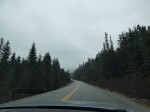
Next stop was Canadian Tire to pick up the bikes and a small portable BBQ. Turned out, my bike was a bit too small but the person in the store helped us raise the seat up a bit without us having to purchase the required tool. Very nice of him. The RV had a big storage compartment in the back which was accessible from the outside and perfectly fit the two bikes. There were lots of little storage compartments which housed the chairs we rented, the BBQ, any wood we found etc. Quite convenient, actually. Now it was time to pick up my parents. We only got a tiny bit lost driving back to the airport but still arrived in good time. Jeff just parked the monster along the road right in front of the terminal while I went inside to get my parents. Luckily, I did not have to wait long until they made it through customs. Even luckier, nobody chased Jeff and the big RV away while waiting for us – that would have been impossible at YVR. Hugs all around and off we went, officially starting the trip. Oh wait, we stopped one more time to pick up groceries and then were on our way. We drove south on Hwy 10 to La Manche Provincial Park. The weather got worse and it rained in earnest and we could not see much of the country side. The park was busy, it was Saturday after all,  and I was glad I had pre-booked the site. Even more so, since our 31ft RV did fit into the site. When I booked it, the max length specified was 28ft. Despite the damp, I went for a short walk with my mom. Jeff and my dad stayed back to assemble the BBQ. There was no power at the site so tonight’s dinner would be from the BBQ. Meat and potatoes – very German.  Although I seem to remember we had some salad or tomatoes as well:-). We were all tired from the long travel and hit the bed early that evening.

Day 2 – June 25, 2017

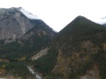
I woke up early and it was still wet out. But by the time we finished breakfast and were ready to go, the sun made an appearance and drove the clouds away. With the sun out our energy levels increased and we were eager to get the show on the road. As mentioned before, my Dad had picked day two’s destination, Cape St. Mary’s Ecological Reserve at the southwest end of the Avalon Peninsula. The drive was beautiful through the open plains – wild and empty looking. Lots of water and lots of grass and low brush. I was hoping to see some caribou or moose but neither made an appearance. Driving along the small country roads, with plenty of potholes, in a huge RV wasn’t getting us anywhere fast but it was a great way to travel. Just before we turned off to the Cape the fog hit us. Cape St. Mary’s is known for its nesting bird colonies that are very close to the path for easy viewing. But with this really dense fog I was worried we would get to see nothing.  We stopped in at the visitor centre first and the ranger on site ensured us not to worry – no matter how thick the fog, we would see the nesting rock. It was a bit of a walk to the nesting rock over wet grass and rock. My poor mom wasn’t quite ready yet for a hike but she was such a trooper making it the whole way with only one slip. From then on, no matter how much I said it’s only a short hike, my mom put her hiking shoes on instead of the slippers :-). The walk out was well worth it despite the fog. The nesting rock was right in front of us, less than 10m way and it was full of birds. The main attraction are the Northern Gannets – tons of them. But also Common Murre and Kittiwake seagulls are quite abundant. The Razorbills are a bit harder to find.  We could not see much of the ocean 50m below us. It must be stunning on a bright sunny day when you can actually see the cliffs all the way to the ocean but the fog did have its appeal too. They don’t get very many sunny days the ranger said. My dad and I had secretly hoped to see puffins but we didn’t.


It was later than I thought when we hit the road again. The road wound its way right along the ocean with many small villages along the way. The fog mostly stayed out to sea and we were able to take in the sights. Newfoundland turned out to be much hillier than I expected – up the hill down into another cove with a few houses, up again till the next cove and set of houses. Really quite scenic but a bit labourious in a 31ft RV.  Soon it was time to find a place to stay for the night. Our options for possible RV sites were quite limited in the area and we weren’t quite ready yet to just camp anywhere. And so we ended up in Argentia because it was the only campsite on route. Argentia Sunset Park just outside of town wasn’t necessarily a scenic campsite, pretty much just a big open lot but they had plenty of space, the sites had power, it was quiet, washroom facilities were very clean and our site featured a view over the harbour and Placentia Bay to the west. Most importantly, it was sunny and warmish and we had a nice dinner and beers sitting outside the RV while watching the sunset.

Day 3 – June 26, 2017

Again I woke up early – not sure why I never have problems getting up early while on vacation compared to work days :-). The evening before we had found a pamphlet in the office that advertised some scenic trails in the area, mainly bike trails, starting not far from the RV park. It was another beautiful, blue sky, sunny morning and even before my parents got up, Jeff and I took off on our bikes to get some exercise. The first part was easy, down toward the ocean where we found the start of the trail – after some searching and ignoring the “Do Not Enter” sign. From there we went along the ocean on an active logging road until the trail cut inland where it started to go up. Quite a bit more up than I had bargained for. My saddle was still way too low and it was hard work pedaling up to the high point on an old gravel road. We did get to see our destination, Gull Pond, way below us but never reached it. I refused to go all that way down only to have to come back up again. I had enough of going up. On the way back we ended up on some narrower trails, I am sure they were supposed to be walking only trails, and the riding almost got technical for the non-mountain biker I am. No crashes though and we made it back to camp (which was up a hill again, sigh) . Just in time for breakfast with my parents after about 2hrs on the bikes. All in all Argentia, despite not being a destination of note, did provide a great camp 2.

Back on the road we turned more inland to rejoin the TCH – that’s what the Newfies call Hwy#1, and it only goes east and west as far as Newfy directions go, even though I was sure we were traveling almost straight north at that time :-).  Today’s destination was the Bonavista Peninsula. Again the scenery along the drive was quite beautiful but it was a lot of driving. We stopped in at the “must go” tourist attraction of the historic town of Trinity. Jeff almost had my head for suggesting that little detour because the road was VERY, VERY narrow and definitely not made for a 31ft RV. Ooops – I guess if I had done some proper planning I would have known. But all went well, and we made it in and out without running anyone off the road :-). The town itself did not seem that exciting to Jeff and I. Just a few more wooden, colourful buildings. Maybe if we had taken the time to read some of the signs, it would have been more exciting.  My dad wanted to try some lobster lunch in town but neither Jeff nor I felt like eating again and my parents didn’t want to go by themselves. I was sure we would find other, maybe better opportunities to have a Newfy lobster dinner but we actually never did. In hindsight, I felt guilty for not giving my parents the opportunity at that time but to be honest I wanted to get going to get to Bonavista – there was a coastal hike listed in the travel guide with my name on it :-).  And onwards we went towards Bonavista. Just before we got there, we sighted our first iceberg!! Our destination was known for being one of the best places to see icebergs. Bonavista was another town with small roads that needed to be navigated to get to the Cape but Jeff was getting the hang of the beast by now. We drove out to the Lighthouse, quite an impressive square red and white striped design. We saw a couple more icebergs far out to sea and a puffin colony with again no puffins. While my parents drove the RV back the Cape road, Jeff and I walked the trail back along this beautiful coastline. A nice 1.5hr long easy walk before we met up with my parents again. They had checked out the “Collapsed Arch Provincial Park” which was just a pile of rocks – as the name suggested.

Now it was time again to figure out where to camp for the night. There was really only one official RV park along the route and it was small. I called ahead to make sure there was space but it turned out they weren’t even open. Some road got washed out. Oops  now what – backtrack to some other campsites we had passed earlier? Risk a 16km dirt road drive to a nearby Provincial Park? Or just keep going and see what we find? And that’s exactly what we did, we had a self sufficient RV after all, may as well make use of it.  We found this beautiful flat spot along the road with our own gravel beach not far from Amherst Cove I think. Here we spotted our first whales. Jeff and I walked out along the cliffs to get a bit closer to the whales for a picture. Jeff almost lost his flipflops along the way – yeah I know “scrambling in flipflops” – what the hell. Damn tourists. Well, he had to go skinny dipping to retrieve his shoe and I am sure the water was freezing. There were iceberg out at sea!!! Another beautiful sunset and BBQ dinner. And the road was very little traveled at night and we got a great night sleep. Now THIS is camping 🙂

Day 4 – June 27, 2017

Again, I was the first one up and went to explore the area a bit. That’s when I saw the moose crossing the road up the hill. Unfortunately I did not get my camera out in time to take a picture. Moose #1, finally. I had expected to see a moose every day, multiple actually, but we actually didn’t really see that many on the trip. But I am jumping ahead. Tuned out we weren’t the only camper. There was what looked like a more established spot on the other side of the road which had a camper in it. I don’t think anyone was there as I walked by to see if I can find the moose in the bush. Off course I couldn’t. There was room for lots more but our spot had a much better view even though it was visible from the road. It is easy to hide though behind a 31ft RV :-). Another sunny and warm day. Only thing that disturbed the idyllic place was the noise of the generator we had to fire up to use the coffee maker and toaster. The inbuilt version wasn’t a nice quite Honda generator we had seen people use at La Manche.

Today’s main attraction, other than a lot of driving again through this beautiful country, partially along the coast and through tiny colourful coastal villages, was Terra Nova National Park.  All National Park entries were free in 2017 – thanks to Canada’s 150th birthday. Getting to the park was where we encountered our only “traffic jam” on the whole trip. It wasn’t really a jam but we had to go slow for 10-15kms. They were resurfacing the TCH through the park.

We parked near Newman Sound Campground, it was well suited for our huge RV but we would not have to worry – we were the only ones there. Here, my parents and us split up again. Jeff and I going for an easy but longer hike along Newman Sound, 9.5km return Coastal Trail, while my parents explored the area closer to the RV.  Both of us though got a nice feel for the area. Forests, sandy beaches, lots of flowers (I particularly liked the Scrotum Flower and the beds of bunchberry), easy trails. Just no moose. We did discovered our first “Red Chairs” that Parks Canada had placed all across their national parks for Canada’s 150th birthday. We made it a goal to always take a Red Chair picture. With all that sunshine and warmth, it was a near perfect day. My mom’s knee also was getting better (which she hurt on day 2 at St Mary’s when she slipped – I still feel guilty about that but she was such a trooper!).

It was too early in the day though to make camp and we decided to push on along route 320 “Road to the Shores”. More beautiful scenery, rolling hills, tiny coves, colourful villages. We passed all the campgrounds and found us a spot in the middle of nowhere again, right on the ocean, near Anchor Brook half way between Lumsden and Musgrave Harbour.  By the way, in Newfoundland, most creeks/rivers are brooks and most lakes are ponds. Sitting in our chairs while the BBQ was going drinking Iceberg beer, watching the sun set and icebergs float by. Can it get any better – other than having a moose walk through camp? Which, of course, did not happen.

Day 5 – June 28, 2017

We woke up to an overcast sky that morning. Quick breakfast and we were on the road again to make it to Twillingate for an iceberg tour by boat. Of course we hadn’t booked anything but the travel pamphlet that we had picked up at the RV rental said there are a couple operators. Due to the lack of sun, there are way less photos of the drive up even though it was just as beautiful. And we didn’t quite know how long the drive would be either. Once in Twillingate, we drove up to the biggest “Iceberg Tours” sign, “Iceberg Quest”. It looked like they were just about ready to go and lucky for us, they still had room for four. Now we had to find a place to park our monster RV. We took up a few car spots along a small park. All good. Soon after we were on board the vessel and moved out into the bay. The first iceberg was just minutes away from the dock. So cool! Apparently, the pack ice had just left the bay a couple weeks earlier – much later than normal. And yes the air was a bit nippy that day. It felt like we had left summer behind in Terra Nova. We also learned, well Jeff did and he translated Newfy to English and I translated English to German – sure lots got lost in translation 🙂 – that most of the icebergs we visited weren’t actually floating but are stuck on the bottom of the sea, some 70m below us!!! The icebergs towered above the small boat and despite knowing that icebergs main mass is below the water it was still hard to imagine. We also got to taste 10,000 year old ice. Very refreshing despite its age :-). And apparently we just missed the big berg that had moved out to sea again a few days before – we could still see it out there cruising down Iceberg Alley. Iceberg Alley is the reason that you can still see icebergs in Newfoundland till early Summer. It goes all along the east coast of Newfoundland past Bonavista (Day 3) and St John’s and up into the Gulf of St Lawrence. This year, they seemed to stick around even longer than the previous few years (just an off year and not to be confused with global warming ending), which was great for us late June tourists but not so great for the locals because it cut their relative short season even shorter. It was an awesome tour and we got close to quite a few icebergs but missed out on any possible whale sightings.

Back in town we decided to try the local cuisine for lunch. We walked all over town first of course before we settled for a place that looked like the locals would go to. It was pretty busy. Unfortunately no lobster on the menu but some cod dishes. All the fish though was deep fried and actually not all that tasty. My salad, well who orders a salad in a fishing town way up north, seemed to have seen better days. But it filled us up enough and after walking all the way back to the RV on the other side of town, we were on our way again. We checked out the end of the road – Crow Head and Long Point Lighthouse where Jeff and I did a short hike partway down the cliff.

Now it was time to hit the road again and cover some ground. We wanted to get to Gros Morne the next day. It started to drizzle and then to rain on the drive. We were looking for a proper RV site that night to recharge our batteries and ended up in Bishop’s Falls. Not the most scenic site, probably the least scenic site on the whole trip actually, but they had warm showers and there was a Chinese restaurant within walking distance. It was too wet for a BBQ dinner.

Day 6 – June 29, 2017

Lucky for us, it stopped raining sometime during the night. Jeff and I were up early again and took the bikes for a spin. Bishop’s Falls is situated along the Exploits River, a well known Atlantic Salmon River and Jeff wanted to have a look-see. Took a bit of searching until we found access to the river. It was a pretty wide, slow moving river in that particular spot, more like the lower Fraser without all the industrial parts, and sure did not look like this great fishing river Jeff had read about. Oh well, at least we were able to stretch our legs a bit before the long, long, long drive to Gros Morne National Park, all of it on the TCH. In theory, if you would go the speed limit, the drive would be about 3hrs but the big RV started rattling pretty badly at speed above 90km/hr. So it took a bit longer. But the clouds opened up as we went west and the sun made an appearance again and by the time we made it to the park it was mostly sunny. We headed into the southern portion of the park first. It definitely was more “mountainous” in the park than what we had seen till then. First stop was the Discovery Centre to get the lay of the land and get some advice on the best hikes in the park. There were so many but the ranger suggested Gros Morne Mountain, the longest of all hikes, as one of her favourites which as it happens was close to the campsite we had pre-booked at Norris Point – booked the night before on my dad’s tablet since it (a) was THE long weekend after all, (b) all National Park sites had already been booked solid and (c) we had a 31foot RV. I thought we were lucky that we still found a spot for our monster RV at the Norris Point KOA. It was still early in the day when we arrived in the park, only 2:30PM, enough time to do a couple shorter hikes. First off, Jeff and I did the Lookout Trail that started right at the Discovery Centre which provided an awesome view of the area and Bonne Bay. And of course there were Red Chairs at the top. The wind was a bit chilly but the sun was out in full force and it was a beautiful little 5km loop which took us about an hour. Not too steep, although too steep for my mom. My parents stretched their legs on some lower trails.

Then we drove another 15min down the road to do one of the parks most iconic hikes and UNESCO World Heritage Site, “Tablelands”. Here you can experience the power of the earth. The geology is quite unique. Caused by colliding continents, a different set of rock was pushed towards the surface in ancient times. Almost nothing grows here and the red rubble/mountain does seem almost out of place in the otherwise very green park. Since this hike was classified as easy, flat 4km return, my parents didn’t get a choice but had to come with us. Their first real hike at over 70 – I hope I can still do that much when I am that age. The hike was really beautiful – not only did the alien looking landscape catch our eyes but also the abundance of pitcher plants along the trail. And even the rain catching up with us on the way back could not wipe the “wow” off my face. We all were a bit wet – worst off my dad who did not bring a coat along :-).

Now it was time to get to our campsite which was on the north side of Bonne Bay. It was quite a drive (~2hrs) to get there but with lots of beautiful scenery to look at along the way never boring. And we saw a black fox along the road but no moose – again. The KOA at Norris Point was a ways out of town but it was quiet and the sites were spacey, had power and provided quite a bit of privacy, being surrounded by bush. We even started a fire, well tried to. It was a bit damp and even though we had collected the wood on day 2 when it was sunny, it was a bit of a smoky affair. But the beer does taste so much better when sitting around a campfire, especially since the rain had also brought on some colder temperatures. Another BBQ dinner night.

Day 7 – June 30, 2017

A non-travel day and we had all day to explore more of the park. My parents took this as a rest day finding a nice walk around a pond right next to the campground, while Jeff and I jumped on our bikes to ride to the start of the Gros Morne Mountain hike, a 16km loop and almost 800m of elevation. Gros Morne Mountain is the 2nd highest mountain in Newfoundland, missing out on 1st place by just 8m :-). We were actually lucky to be able to do this hike – it is usually closed from May till the end of Jun to protect the local wildlife raising their young (ptarmigan and fox). Jun 30th was it’s opening day that year. Getting to the trailhead was super easy – just down the big hill. I was a bit worried about how to get back up after finishing a 16km hike but those thoughts were pushed to the back of my mind as we started the hike. It was a 10-15C day with a mix of sun and clouds, pretty ideal for hiking. The first 4km are fairly flat and the trail winds its way through forest and bush with the occasional view of your destination. Once you reach the bottom of the climb, where the loop starts, it’s a steep 500m straight up to the mountain top. But you can stop every so often to enjoy great views over Bonne Bay and the Tablelands to the south. As you ascent, you are entering the harsh but beautiful Arctic-alpine environment of moss and alpine flower or for the first bit just simple crushed rock. The views are amazing and once on top the hiking is easy again. You walk along the fairly flat summit for a while till you reach the drop off to Ten Mile Pond and the long Range Mountain Chain – stunning. Here we sat for a while and Jeff got the binoculars out to find moose. And he actually found one – far, far away on the other side of the lake and hardly visible even with the binoculars. Apparently the moose population in Gros Morne is huge, over 3000 strong so we better had to see one. Moose are actually not native to Newfoundland but were introduced over a century ago. Due to the abundance of food and few natural predators they have almost become a pest, turning a mature forest over a few decades into open, sparse woodland as their main diet consists of young trees and brush. Now there are programs in place to actively manage the moose population, via controlled hunting and the park shows signs of recovery. Some areas are fenced in to keep moose out and the difference in underbrush is amazing. Besides moose, the park also features caribou, black bears and foxes of which we saw nothing on this hike. You descend down the mountain a different way than you came up. There were actually stairs near the top. This is where most of the arctic plants started up. We saw some moose tracks at the bottom of the stairs and as we slowly worked our way across the mountain side through tundra and stunted trees, the Newfy term for it is “Tuckamore”, I all sudden smelled – cow or maybe moose!? We rounded a little bend and there he was! A male moose not 20m above us on the hill, two actually. I was stunned. So close! I am sure they knew we were there but could not be bothered and kept eating away. I could not believe my luck. We stayed with them for a few minutes. A couple other hikers came up behind us and watched as well. UNBELIEVABLE! Eventually we moved on towards Ferry Gulch and the way down past another little pond with a rustic wilderness campsite on it. Newfys take the term “outhouse” to the extreme. It’s a door, the rest of it is open to the elements :-). From here it was an easy hike down to the bottom of the mountain and back to the parking lot – what a fantastic hike. It took us just over five hours. Now came the hardest part. We had to ride our bikes back up this long hill. It wasn’t too steep of a hill but with my saddle being way too low it was too much for me and I had to walk a bit of it. Took quite a bit longer on the way back but the hike was well worth it.

Back in camp my parents were waiting for us. They had a quiet relaxed day which was what they needed. We took the RV and drove into Norris Point. Someone at the campground told us that you can catch a water taxi across Bonne Bay and visit historic Woody Point. But it was too late in the day unfortunately. So we just had a late lunch – an assortment of snacks of which the deep fried cod bites were the best we had on the trip. We continued on to Lobster Cove to visit yet another lighthouse and strolled around in the area. The weather was getting more and more overcast. I believe this is also the same evening where we ate at Jackie’s Restaurant in Rocky Harbour (or it was the night before). A tiny little place, which felt more like someone’s living room than a restaurant that had a nice view of the ocean. The food though, wasn’t all that great. We spent the evening in the RV planning the next day. The same someone who told us about Woody Point had also suggested to visit Western Brook Pond – the one that is in the TV commercial and was the reason I wanted to see the park in the first place, I just didn’t know it was called Western Brook Pond. There was a 3km easy walk to the pond and then a boat ride to the end of it. Perfect for the 4 of us to do together. The pamphlets we had picked up at the Discovery Centre had the boat departures listed and it also said that reservation is highly recommended. Of course we did NOT make a reservation.

Day 8 – July 1, 2017

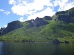
Happy Birthday Canada! We woke up to a mix of sun and clouds and it looked promising for our trip to Western Brook. We took off early to catch the first boat tour of the day at 10AM. The walk to the boat launch was stunning. The trail amazing – boardwalk through the wetlands and gravel through the forestry portions. Most of it was wetland with view of the mountains on the horizon. I was fascinated by all the sundew along the trail and we took our sweet time. We arrived at the boat launch an hour before the boat was supposed to leave and we actually still got tickets. Unbelievably lucky since the tour had been 98% booked out!  And I am glad we did not miss out on this. The boat tour takes about 2hrs through this iconic freshwater fjord with its stunning billion year-old cliffs and waterfalls cascading over 650m meter high walls. Jeff and I got a spot right in front and the best views. It could have been a tad warmer but otherwise it was a picture perfect day with the sun driving the clouds away more and more. From the tip of the fjord one can actually do a multiple day hike back to Gros Morne Mountain through the Long Range Mountains which must be amazing. But we took the boat ride back, sigh.

The sun was out in full force for the walk back and the landscape seemed even more beautiful. Back at our RV we started heading North. We made one more quick stop in the park to look at Shallow Bay – featuring a beautiful  white sandy beach. I went for a short walk but the other three just sat in the sun for bit. We continued on North along A430.  The next stop wasn’t too far away, Arches Provincial Park. A nice 3-arch rock formation right on the ocean. Well worth a quick stop and off course Jeff and I had to climb up on it :-).

Route 430 actually winds its way along the ocean the whole way and the views are quite spectacular on a sunny day. We had planned to stay near Hawke’s Bay at an RV park along the Torrent River, another river famous for its Atlantic Salmon run. When we drove into the campground it looked pretty busy. They had a big potluck going on from the looks of it. Obviously, we had not booked ahead and even more obviously, it was July 1st and a long weekend. This place seemed to be popular with the locals and was fully booked. Or maybe they did not want to deal with any newcomers during their Canada’s 150th birthday celebration gathering. But they suggested another RV park in Port au Choix. It wasn’t quite along our “planned” route but it was only a short 30-40km sidetrack. With the hwy so close to the ocean, we did not see any good spots to just pull off for the night either. And so we were on our way to Port au Choix, a small headland sticking out into the Gulf of St Lawrence. The RV park was pretty much a big parking lot but it was almost empty and right along the ocean with spectacular views, just outside of town. The person who booked us in was super friendly. Shortly after we parked the big RV, someone from town drove by to invite us to the Canada Day bonfire in town which would be lit up around 10PM. We had some time to kill.First we walked the rocky beach for a bit to look at fossilized something, then sat around, drank beer, had dinner and chatted with the camp host. He told us about the caribou that sometimes come into town in the evening or had recently been hanging out around the French Cultural Centre on the way to Richie Point lighthouse.

So Jeff and I hopped on our bikes and road out towards the lighthouse. It was maybe a 15min ride to the cultural centre. It was already closed and there were no caribou in sight. Since we were already here we decided to continue on towards the lighthouse. It was after all such a beautiful sunny evening. And that’s when we saw her – a female caribou just 100m or so off the road. Yeah! We watched her for a little bit and then rode on towards the lighthouse which was quite a nice one and it had Red Chairs! We sat down for a bit and watched the whales blow out at sea. It was a gorgeous spot, really. Who knew! I can highly recommend making this little side trip of 30-40km when on the way up to L’Anse aux Meadows. We saw the caribou cow again on the way back, even closer. She seemed to be used to visitors. Back in town, the fires were being lit. There were two. The first one we came to was made of old lobster traps. It was huge and the burning traps sure were a sight to see. We rode back to the RV park to get my parents. My mom was too tired but us and my dad walked back to town and joined the closer by bonfire. It was smaller, no lobster traps but it also featured music, a guy in a hockey jersey playing the guitar. There were a lot of people, bringing their booze with them – nobody seems to care. There were lots of kids running around – they were fun to watch. Everyone knew  everybody, except us. Quite a way to experience Canada’s 150th birthday in a small fishing town along the Gulf of St Lawrence. It could have easily been 1867.

Day 9 – July 2, 2017

I woke up quite early, just after sunrise, and went for a stroll through town on my own. The early morning light made for some great pictures and with the exception of a couple fishermen I seemed to have the town to myself.

Before we got back onto the highway north, we went out to Richie Point one more time. This time in the RV bringing my parents along, with the faint hope of maybe seeing the Caribou again. And guess what, we did see her again and this time she had male company. They came quite close crossing the road and then we lost sight of them. We drove to the lighthouse to have breakfast and for Jeff and I to do a short hike along the ocean through limestone barrens with rock formations that looked like dinosaur poop. Took lots of pictures of rocks and flowers and ocean and ran out of battery the moment we saw the two Caribou again. Well I got a couple shots off when they were coming towards us but when they literally walked right by us, the camera went dead. We could have almost touched them. I guess they are quite used to people and probably do get treats here and there. Port au Choix definitely was an unexpected highlight of the trip.

We continued on along Route 430, the Viking Trail, up the Great Northern Peninsula. For the most part the road follows the ocean and you can get a glimpse of Labrador across the Gulf of St Lawrence. As we traveled north, the sky clouded over more and more. Eventually the road turned inland towards the eastern tip of the Peninsula, towards L’Anse aux Meadow and the Vikings. When we reach the end of the road, we still had enough time left to visit the National Historic site. But man was it ever cold – quite a difference from when we left Port au Choix in the morning . It was overcast and windy. And  of course we could see icebergs out to sea. It felt like zero degrees! We quickly dug out toques and gloves and warm sweaters. We first explored the visitor centre to warm up before going outside again to see the reconstructed Viking village. They did a really good job. Even “real” Norse men were around to answer any questions one may have. Usually they walk around outside but that day, they were huddled up in the hut with the fire place :-).   It was very interesting but a few degrees warmer would have made a world of a difference. It was July 2nd for crying out loud! I am sure I saw some flurries near the end.

We found an RV park in Quirpon, not too far away. By now it had started raining and it was quite miserable. The RV park was right near a lake but it was to miserable to explore much. Some of the sites in the trees, tent sites, still had snow in them! Hence that day, we huddled up in the RV, fired up the furnace, read our books, played some dice games and drank beer. I also looked up the ferry to Labrador on my dad’s iPad. I was worried it would be hugely expensive to take a 31foot RV onto a ferry for a one day trip, being used to BC Ferries prices, but was pleasantly surprised that it was only $67 one way. So we finally made the decision to catch the 2:30PM ferry the next day if they have room for us. There is only one ferry that goes back and forth 5 times a day.

Day 10 – July 3, 2017

Luckily the rain had stopped, even though it was still cloudy out. I was up first again and went for a walk along the road for a bit to explore one of many wood piles along the road. You see them everywhere along the road. Nicely stacked piles of cut wood. I was wondering who they would belong to – we never took any. This one even had some kind of primitive lumber saw setup so I went in to take some pictures. Sure enough, it took only a few minutes and a pickup truck stopped along the road eyeing me suspiciously. Obviously the locals thought I am a wood thief :-). So I left before I got arrested for stealing the soul of a wood pile taking pictures.

Since we still had plenty of time before catching the Labrador ferry, we decided to explore St Anthony and do the Dare Devil trail, 400 steps up a cliff near the lighthouse. But somewhere along the way  we must have taken the wrong turn and we ended up in, I think, Goose Bay. Another dead end. Clouds were still hanging low over the town and bay but it wasn’t raining so we got out to walk around. We are here already, why not explore a bit. There was a nice flat trail out towards the ocean and a viewing platform. It was not nearly as cold as the day before and the views were quite nice. Of course there were more icebergs to watch :-). By the time we turned around the sun had started to push the clouds away. And when we finally found St Anthony and Fishing Point Lighthouse and the Dare Devil Trail, it was bright sunshine and blue sky! We made it up the 400 stairs, my parents stayed below, and enjoyed a quick look over St Anthony Bay and the open ocean.

Now it was time to head back south and try to get onto the ferry to Labrador. On the drive across to the west side of the northern peninsula we got to see another moose running along the road. The only road moose we ever saw and lucky for us it cut into the bushes and not across the road.  The west coast was quite foggy. We made it to St Barbe in good time and, yay, they still had room for our monster RV. The MV Apollo arrived on schedule and after a not too long wait we were on our way to Labrador. The crossing takes 1hr45min and we did not see a thing – it was totally foggy with zero visibility. I was sure we would hit an iceberg. But we didn’t and arrived on time in …Quebec!  Blanc Sablon, is where the ferry terminal is and that’s in Quebec. But it is less than a 5min drive to Labrador from there. Well, it would be less than 1min if not for all the potholes. Now in Newfoundland the roads weren’t always in the greatest shape but they were safe to drive on. In Labrador, the potholes were gigantic and deep, and I would have bet money on us getting a flat tire. We had no idea if we even carried a spare, never mind how to jack up a multiple ton, 31foot long RV. Oh well, we were here now and we weren’t going to turn around without exploring at least a little bit of Labrador. On we went, slowly, to avoid the worst of the potholes and because it was still foggy. But as we traveled north the fog moved further out to sea and we started to see a bit of the rugged landscape. As always, I hadn’t really made any plans on where to stay for the night. There wasn’t anything obvious in any of the small towns and we worked our way up to Pinware River Provincial Park. And as usual, we totally lucked out with that place. It was in the sun, right along the ocean, beautiful sandy beach, easy to get in spots and hardly anybody there. Just no power but we had plenty of charge on our batteries. We even managed to get a smoky fire going – very nice. A great place for our one and only night in Labrador. Jeff and I took our bikes for a quick spin and I finally found someone with tools to lift up my saddle. There was a guy with a motorcycle who was on his way to Labrador City and you don`t do that trip without tools. So finally, I could ride my bike without the knees hitting my chest :-).

Day 11 – July 4, 2017

The day started out overcast again but no rain. We still had most of the day to explore before we had to catch the ferry back. Hence we headed north to Red Bay and the end of the “paved” road. The landscape was quite beautiful. A bit more hilly than Newfoundland and even more remote, desolate looking. I loved it. Red Bay is a small town. It originated as a whaling station for the Basque fisherman in the 1500’s that traveled across the Atlantic from southwestern France and northern Spain in the hunt for whales. Whales provided a source of oil for fuel and lamps, and the oil was in high demand in 16th century Europe. Today Red Bay is a National Historic Site (http://www.historicsites.ca/red-bay/?gclid=CjwKCAjwnLjVBRAdEiwAKSGPI2Ihs4IfjM6QiI1QpBZ2HX0bKgzejmOhdXOjZB4PR8_VxAsC4Mf5bhoCoIIQAvD_BwE) and the museum is well worth a visit. We spent a good couple hours to explore the exhibition. Because it is all in English, my parents didn’t quite spent that much time at the museum and went for a walk through town. Except I did not know that and when it was time to leave, I could not find them. Jeff and I split up to search for them. It didn’t take long until I managed to catch up with them. Red Bay is not that big :-). We were on a road right next to the bay when all sudden a Minke Whale surfaced right beside us. Wow! We only saw him once but it was so cool to see the whales return to a place where they had almost been hunted to extinction.

The weather had improved a bit too and the sun was trying to break through the clouds. We stopped in for a short hike to Whalebone Beach on the other side of the bay. My dad and I went to the beach to search for whale bones that had been left here for hundreds of years while Jeff ran up the stairs to a lookout. Well, we did find some very old looking bones but not very many and by far less impressive that I had expected. No full whale rib cages or skulls. What we saw made sense, given that these are hundreds of years old but both my dad and I were a bit disappointed. The view over Red Bay and the old whaling stations was quite nice though. Jeff was happy with his run and we met right where our trails had separated.

Back on the road, navigating potholes. Actually they were less bad than they had been between the ferry terminal and Pinware River. Now with the sun out once in a while, the country we drove through looked beautiful and Jeff and I fell in love with Labrador for no real good reason but we both wanted to come back here. We made one more stop along the way to have a look at Point Amour Lighthouse Provincial Historic Site, featuring the tallest lighthouse in Atlantic Canada, 109feet/33m high. We could see our ferry coming across the Gulf. And we saw big groups of seals charging through the water just off the beach. Last but not least we were entertained by a ground hog. We also passed a ancient burial mound of a Maritime Archaic Indian girl but there was not much to see.

Now it was time to head to the ferry terminal to catch the last ferry across for the day. This time though, the boat was pretty busy and we were 13th in line for standby. No chance we would get onto that ferry with our 31foot RV, I thought. But Labrador ferry workers are 100 times more efficient than BC Ferries ferry workers. Not only did they squeeze our 31foot RV into that boat but another semi truck AND trailer. It was tight and they made Jeff back up and go forward a few times to optimize the loading. Nobody got left behind! AMAZING. And we pretty much left on time too. I would have given the guy who got us on a big hug if I could have found him on the boat! It would have been a big rush to get back to St John’s if we had missed this ferry. Instead we had plenty of time to explore more. The crossing was much more exciting this time as well. It was flat calm and sunny and we spent the time outside watching icebergs, fishing boats, many whales and a pod of dolphins. There was so much going on in the Gulf of St Lawrence, the time of the crossing just flew by.

From the ferry terminal we headed south back to the northern tip of Gros Morne National Park, about a 2.5-3hr drive. We had hoped to get a spot at the National Park campsite at Shallow Bay and got lucky once more. They had plenty of space. They also had plenty of mosquitoes.  Especially at the entrance booth where we booked in.  Poor Jeff had to get out of the RV to pay since we did not want all those mosquitoes inside the RV. He got attacked right away. We almost decided to just leave and find a different campsite. Lucky for us though, the mosquitoes weren’t nearly as bad at the actual camp site. We were able to eat outside without being eaten and then went for a nice evening stroll along the beach and watched a beautiful sunset.

Day 12 – July 5, 2017

We woke up to brilliant blue skies, sunshine and nice warm temperatures. Despite having a long drive ahead of us, we wanted to get close to Terra Nova for the night, we had enough time for one last hike in Gros Morne National Park. Jeff and I picked Bakers Brook Falls, a 10km return hike to a beautiful waterfall, while my parents picked a couple shorter loops around Berry Hill Campground. The hike to the falls was nice and easy through a mix of forest and wetlands with only little elevation gain and some nice views towards Gros Morne Mountain to the east and the ocean to the west. The falls themselves were actually made up of several drops. Quite impressive.

We were back at the RV 2.5hrs later. My parents were sitting in front of it enjoying the sun. The rest of the day was spent driving. Only stops were for gas (yep, we did that a lot), coffee for my mom and ice cream for the rest of us and shopping for food. It was a nice day and the drive was uneventful. Question was where to stay that night. I guess we could have pushed on to Terra Nova to stay at Newman Sound but I had found a note about this little rustic campsite just north of Gambo that was situated along one of the famous angling rivers, Middle Brook River, called “David Smallwood’s Rustic Campground”. And rustic is was. All the fully serviced sites were already booked out but we found a nice site close to the river. Just down a steep bank, there was a little waterfall and ponds full of – fly fishers. We watched them for a while and walked along the banks for a bit. It was such a nice night. I sat along the falls to see if I can spot a salmon jump. I didn’t see any. Neither did I see anyone catching fish. There seemed to be way more fishermen than fish. It was still early in the season.


Day 13 – July 6, 2017

Another beautiful sunny day and actually quite hot. We stopped in at the Terra Nova Discovery Centre where my parents found stuff to do while Jeff and I went for a hike to Blue Hill Pond along the Goowiddy Trail and then down into Buckley’s Bay, combining forest, wetland and ocean views. Goowiddy is a low shrub of the laurel family but there was a lot of plant life along the way and we could not figure out which one was Goowiddy. Hence I took lots of pictures for later :-). After about 2.5hrs we met up with my parent again and drove to Sandy Pond. There was a short, 3km level hike around the pond and we dragged my parents along for it. Actually they came quite willingly. My mom and dad had started to develop hiking legs and it was such a beautiful day for a stroll. We took our sweet time and all was good. I had hoped to see some beavers or moose but no such luck. Even the frogs, which we could hear, were nowhere to be seen. We tried hard to spot one.

From here we headed south again towards the Avalon Peninsula. We were hoping to get onto a Puffin tour on our last full day in Newfoundland. Witless Bay Ecological Reserve is a small set of 4 small islands just to the south of Bay Bulls. The reserve contains North America’s largest Atlantic puffin colony. More than 260,000 pairs of the province’s official bird nest here during the late spring and summer. They come for the same tiny fish that all the humpback and minke whales come up here for each year. So we may also see whales although it was still early in the season for whales. I found this RV park, The Celtic Rendezvous, in some brochure promising awesome ocean views. It was a bit of a drive to find and we had to navigate down into Bauline East but they had space for our monster RV. The RV park was just one big parking lot but the views were quite nice. Most of the area was a hotel and they were booked out for a wedding. So we did not have access to the showers but the RV site did have water and power. What else would we need. Also, the very friendly host booked us on a Puffin Tour for the next day on the “Molly Bawn”. We were all set. After dinner, Jeff and I went for a short walk through town where we picked up a new friend – a most friendly dog, who happily followed us all the way back to the RV park. It almost looked like he wanted to be our tour guide :-). He stuck around our campsite for a while. Too bad my mom had gone to bed early that night. She would have loved that guy.

We shared the campground with a couple other RVs, same size as ours, and sat around the bonfire with some of the locals. They had just come back from spending the winter in Florida and we shared our stories. Newfies are quite a proud and friendly bunch of people for sure.

Day 14 – July 7, 2017

Puffin Day!!! And it promised to be a nice one. A bit breezy but the sun was out again in full force. It was a bit tricky to find parking for our huge RV near the boat launch and we had to walk for quite a bit and were almost late arriving. But there were only about 10 people on that little boat. It was tiny and very cute. Off we went. Our tour guide, Jeannine, was German but has been in this area for a few year doing these tours. One could tell she loved it. The ride was a bit bumpy. I was the first to spot the whale – 2 humpback whales came up and checked out the boat. I was in heaven. They were right beside us and you could see them turn under water to look up at us. Bingo!!! We hung around as long as we could but at the end we were on this tour to see the puffins. On we went to one of the islands, Green Island, I think. As we got closer, there were hundreds of birds in the air – besides puffins there a Kittiwakes, common murre and other sea bird. Some were resting on the water but none were ever sitting still enough for pictures. Especially the puffins always either dove away or flew away.  Finally at the island we saw bald eagles – which was bad news because they make the puffins hide in their burrows or fly away. We saw Kittiwake and their just day old chicks. And we did see puffins up on the cliffs, quite a lot of them but I needed a better zoom and much calmer conditions to get any good pictures. Jeannine actually was much more lucky than me and Molly Bawn does always share all their pictures which was great! It was amazing to see this many birds though and way too soon we had to return to shore. The tour was only 2hrs long but I can highly recommend the crew of the Molly Bawn!

We still had half a day left, a beautiful sunny day at that. We decided to explore more of the Avalon Peninsula and headed south on Route 10. First stop was Ferryland. To get close enough to the Point and the lighthouse to not make this a major hike, we had to navigate a very narrow, gravel road in our monster RV. Well, Jeff had to. The guide had mentioned it would be a narrow road but it had failed to say, RVs should not go there. Jeff was not happy with me, thinking we would have to back up all the way back since there was no way to turn the thing around.  We eventually made it to a place where we could park and turn around the RV. From there, my dad, Jeff and I walked for a kilometer or so out to the lighthouse. It was still quite windy but the views were nice enough. The lighthouse actually offers “pick-up lunch packages”, if you pre-book. People were sitting all around the lighthouse along the slopes eating lunch. Quite an interesting concept really and if not for the wind, a nice day to do it too.

We carried on south towards “Chance Cove” Provincial Park. I didn’t really know what to expect but it was another provincial park on the map that could be worthwhile to explore I thought. Nobody had any better idea and so we went. The thing I did not know was the fact that the last bit was on gravel road. When we turned off the Hwy onto the gravel Jeff immediately asked, “How far?” I didn’t really know the answer but kind thought it might be 4-5km. I did know if I tell Jeff it would be this far, he would not want to go. So I kinda said “Does not look far on the map”. I could see the doubt in his eyes but he went with it. It was slow going but the road actually wasn’t all that bad, I thought :-). And when we finally reached the end of it, the whole parking lot was full of large camping trailers, some of them dwarfed our RV! This isn’t an actual campsite but you are allowed to camp in the parking lot apparently. All of those trailers seem deserted. We were the only people there. We still could not see what the attraction was but after a short walk up a small rise the views opened up onto this large bay with a long gravel beach and green meadow in behind. It was screaming moose country – but we didn’t see any. Definitely was quite beautiful – in the sun. As we gazed over the meadows, the beach and the ocean, we saw a whale blow in the distance. And then another one, and one more and …. many more. There must have been 30 whales in that bay feeding, breaching, fin flapping. AMAZING.  Unfortunately they were quite far out to sea. Jeff and I hiked up to the tip of the bay to get a bit closer view. We must have watched the show for over an hour, until it was time to head back. Definitely one of the highlights of the trip. Making Jeff drive the big RV on a gravel road for 5km each way and risking a flat tired on our last day had proven to be worth it :-).

Day 15 – July 8, 2017

Here we go. Our last day in Newfoundland and we woke up to thick fog and a light drizzle. We still had almost all day before our flight but had to return the RV in the morning. That meant we had to dispose of the “Black Water”. If you don’t own a trailer you may not know what that means. The RV has 3 tanks. One for fresh water, one for grey water (kitchen sink water) and one for black water (yep, the toilet stuff goes here). So you empty the black water first and then rinse everything with the grey water. Lucky for us they had provided gloves. And even more lucky, we only had to do this once at the very end of the trip. Hallelujah to a 31foot RV and large water tanks :-). I prefer outhouses over having to empty black water to be honest.

We had planned to leave the luggage at the RV rental and pick it up on the way to the airport later that day after exploring St John’s for a bit. In theory that would not have been an issue but the airport is on the opposite side of town and the guy who had rented us the RV came up with the brilliant idea of calling “The Rooms” and ask if they would store our luggage. And they said yes. I had no idea what “The Rooms” are. Figured it was some kind of hotel. Wasn’t even sure I understood our friendly driver – i think his name was Gary – correctly. But the place was located right in the middle of St John’s. We again got a free ride to that place by the RV rental people. Their in-person customer service sure made up for all the trouble I had booking the RV via email and phone.

Turned out that “The Rooms” are part museum and part archives. Pretty cool actually and a great place to spent a rainy day. But of course me and my dad, had to go and explore. So we all walked down towards George Street. By now it was really raining, and it was windy, and it was cold. All those colourful building that St John’s is so famous for didn’t quite look all that bright. The right thing would have been to hunker down somewhere and get drunk. But not my dad and I. We split up again to meet a couple hours later at one of the bars. Jeff and I headed towards The Battery and up Signal Hill to get a view of the city and my dad and my mom went to explore the ocean front. It was quite a long walk. We could not even see the top of the hill. And eventually we gave up and jumped onto the free tourist bus back into town. We were soaked to the bone. My parents were already at the pub. My mom looked miserable and her and Jeff both agreed that next time they would just send my dad and I out into the rain alone :-). Damn explorers! Anyways, we wrapped up the trip with a couple good beers, some okay food, and some excitement when the awning outside the pub collapsed under all the rain water that had been collecting in it :-). St John’s sure did not show itself from its best side. Rain when we arrived, rain when we left. But all the in between more than made up for it. And traveling by RV was a great way to explore the land and to some extend its people. Jeff and I will be back some day.

The flight home, Vancouver that is, was uneventful and long but without any sprinting between gates in Toronto.

September 30, 2018

Totally Unplugged 50

Filed under: Animals, Canada, Kayak, Travel — K2 in Canada @ 12:06 PM

It was a bit of a last minute decision to still go for our kayak camping trip this year. I only had 2 weeks to plan and prepare the food and get ready (my lists from previous years sure helped). But then, we were going back to the Broughton Archipelago to do a shortened version of the trip we did a couple years ago (see here) instead of heading into the unknown of Knight Inlet which had been the original plan. That took the stress of locating suitable campsites away. Plus the weather forecast looked actually quite decent for the North Island, till the day before we left. I was ready to unplug myself. What could be better to celebrate my 50th birthday than spending time on the ocean! And it turned out to be an epic trip! Weather could have been better but the amount of marine creatures we saw was extraordinary. No bears though, just a few minks that eluded my camera each time.

If you have time for 300+ pictures –  click here for the picture summary of the trip. For a full trip report and a “few” selected pictures read on.

We had 6 nights to spend in the Broughton Area – not enough to go around Gilford Island again but just enough to make it back into Grappler Sound.

map (Medium)

Day 1 (Thu, Sep 13): As usual we hit the early ferry from Horseshoe Bay to Nanaimo, 6:30AM. It was busier than I expected for a mid week ferry. It was raining when we left home but the sun started to come out around Campbell River. And we still had a mix of sun and clouds as we arrived at Alert Bay Resort and 12:30PM. It took about an hour to check in, unload the car and pack the kayaks. There was hardly any wind when we left Alert Bay but there was a strong incoming tide. One would think that should push us towards our destination but the currents can be quite funny in that area. On one side of the channel they go one way, and on the other side they go the opposite direction. We had our route mapped out to stay out of the strongest currents by cutting over to the tip of Malcolm Island. Initially the plan worked perfectly and it didn’t take long for our first wildlife encounter. A pod of Pacific White-sided Dolphins just off the Pearse Island group. Very cool! As we continued to cross over towards Malcolm, a couple of humpbacks came up right next to Jeff’s boat. And more blows ahead of us. That kinda took us off course a bit. Another humpback came up next to Jeff’s boat and before we knew it, we were too close to Stubbs Island and in the main current (3knot = 5.5km/hr) and our traveling speed dropped to 3.5km/hr. But the whales were worth all the hard work. It just took us an extra hour to paddle to Flower Island than we had planned (3hrs15min for ~20km). Oh well, the weather was pretty nice, just a couple quick drizzles, and there was not wind. But we felt that paddle (or maybe it was still leftover fatigue from the Indian Arm Challenge) by the time we hit the beach at Flower Island. To our delight, there was nobody there. It was high tide and the beach was almost completely gone. We rested a bit on the rocks to maybe get a glimpse of another humpback in Blackfish Sound but they seemed to be feeding elsewhere. But we did have a couple sea lions visit the bay in front of our beach that evening. We got the tent and tarp setup just before the rain hit at about 7PM and despite everything being a bit damp on the beach Jeff managed to get a campfire going.

Day 2 (Fri, Sep 14): It rained almost all night but stopped just before it got light. We stayed dry inside the tent but had to back everything up soaking wet. Oh well. We got up at 7AM to a misty morning but there was a hint of blue high above us. Just before we left we had a few dolphins chase some bait through our bay. They didn’t stay for long and we hid the water at 9:15AM. We worked our way up in between Crease and Berry Island and then crossed over to the Indian Group. That’s where we encountered another group, or maybe the same, of dolphins, less than an hour into our paddle. Took us a bit to catch up with them since they were booting about in a large area. But finally we got close, or rather they got close. They came up right between Jeff and I at full speed chasing bait – I got a picture, rather bad quality mind you since neither I or the camera were ready for that, to proof it. Another time they popped  up right around the tip of my boat – no picture. It was incredible and we must have spent close to an hour watching dolphins! Eventually we let them go and continued to push on northwards, past Midsummer Island through Spring Passage, up Retreat Passage in between Bonwick and Gilford Island, past the Fox group where we saw another kayaker on shore and into Cramer Passage. By then the sky had turned an angry gray and the wind picked up from the east. Jeff had slowed down considerably and I was worried his wrist (the one he hurt in Aug) was acting up again. Turned out later that he was feeling off but it was his should blade muscle that complained and not his wrist. But I did not know that while we paddled. It took us forever to get to the Burdwood Group (6hrs30min, 35km). The last bit, crossing from Baker Island to the Burdwood into a heavy cross/headwind. I was sure we would have to cut our trip short. The wind was blowing into the campsite but we managed to set up the tarp and tent. The cabin was still there but we had the site to ourselves (I still did not see any of the other sites in the group of islands). It was cold! After dinner, to warm up, I decided to go for a short stroll in the forest in behind the camp. There was a clear trail that got me to the other side of the Island. But on the way back I lost my way – I NEVER get lost!!! But after I stepped over the same log for the 3rd time I started to panic. Which was kinda stupid since the Island isn’t that big. Instead of doing the smart thing and bushwhacking along the shore I started yelling for Jeff to get my bearing. It took a lot of yelling since he was upwind from where I was. It started to get dark! Eventually he found me. It was literally just down the hill from where I was. SCARY!!! At least both of us got the bad day out of our system :-). Shortly after we got back to camp the rain kicked in. And it rained all night again.

Day 3 (Sat, Sep 15): We were up around 7AM again. It was still raining. It didn’t stop until we loaded the boats and were ready to leave. Jeff and I discussed our route – should we push on to Watson Point or should we do a short day to Moore Bay. Friends of ours had recommended Moore Bay in Kingcome Inlet and I was keen to see it but rather on a nice sunny day to actually see the surrounding mountains. The first bit was the same route and we decided to push out the decision until Hayes Point. The clouds were still hanging low but the rain did stop when we left the beach at 9:20AM. And we had a nice tailwind pushing us. Almost got to ride some waves in our heavy sea kayaks crossing from the Burdwood to Penphrase Passage. The passage itself was flat calm but here the current helped. We reached the decision point much quicker than we thought. Both of us felt good and we decided to push on to Watson Point in Grappler Sound. We had done this before, two years ago, and can do it again. With either the current or the wind helping us we covered the distance to Watson Pt in less than 5.5hrs (much quicker than 2 years ago). It was a pretty uneventful paddle in regards of animal sightings – kinda none – and it stayed overcast all day but it still felt good. One of those days where you can feel the history of the area, the struggles the early loggers and fisherman had to go through in this unforgiving part of the coast (see book “In the Heart of the Rainforest”). We reached Watson Point in the early afternoon and a light drizzle started as soon as we hit the shore. We were wet and cold as soon as we stopped paddling – in hint sight it was good we didn’t encounter anything of interest on the paddle. It actually was cold. The max Temp that day for Port McNeill was 12C! Even changing into our dry land clothes didn’t help all that much. We got the tent and tarp up and then started looking for some firewood. Everything on the ground was damp and/or rotten. Luckily we found a small dead cedar tree in the forest in behind the tent that was still standing. So Jeff cut it down with our little pack-able saw and that wood was awesome! It burnt nice and hot and sure saved the rest of that day. One more little oops happened that day – I managed to burn dinner, in minutes! Even before I added the rice. We were supposed to have mushroom soup that night and the recipe ask for milk instead of water. So I added a bunch of powdered milk. I think that’s what actually burnt on the bottom of the pot. There was no way it was eatable. No worries though, I always bring spares and so we had tomato vegetable soup with the rice and Ukrainian sausage. I think that actually turned out to be the better meal anyhow. Jeff managed to find some porpoises in Grappler Sound but they were far, far away and hardly visible with the binoculars. We hung around our little fire till it got dark. That’s when we had a visitor. Something was walking down the banks from where the tent was set up. Something with size. We made noise which scared it away right away. Never saw what it was. We checked the area with a flash light but could not see anything. Could have been a bear, could have been a coyote or wolf or deer. I did not sleep well that night listening to every sounds outside the tent while the rain and water dropping from the tree was creating a lot of noise.

Day 4 (Sun, Sep 16): Nothing showed up to eat us that night but the rain was relentless. It still rained, well drizzled, when we got up. It still rained when we had breakfast. It still rained when we packed up the tent – soaking wet. It still rained when we packed up the boats. Mind you it did start to get brighter to the southeast and we actually think we saw a rainbow against the opposite shore. We left late, around 10AM, and it actually stopped as we started paddling. By that time we had already decided to not paddle around the top of Grappler Sound but to head south towards the open strait to see if we could escape the clouds that seemed to be trapped within the steep mountain sides of the inlet. And our destination for tonight was a new one for us – Polkinghorne Island – and we wanted to have the option to find a different site if it turned out to not work for us. Hence we worked our way down Grappler Sound into Wells Passage. It was kinda cold having to paddle into a bit of a headwind. Secretly I had hope to encounter the pod of dolphins again that entertained us 2 years ago but we weren’t that lucky. We stopped in on a rocky beach on the mainland side to replenish our drinking/cooking water, Wehlis Bay I think. There was a nice little creek but the water was dark. Good enough for cooking though. We crossed over to the Broughton Island side of Wells Passage. We hugged the shore past Bourmaster Point to cruise along the shore to have a look at Carter Passage. Some day I want to paddle through there and head back towards Kingcome Inlet but the passage runs dry at low tide and the chart says there is a 7knot tidal rapids. We saw it on an incoming tide that day and it looked very benign. Mind you, we have encountered tidal rapids before and they can be vicious and you have to hit them at exactly the right tide to make it through. Not knowing enough about the passage we decided against trying it on this trip. The weather forecast was good for staying at Polkinghorne in the open and promised a northwesterly to push us back into the Broughton Archipelago the next day. As we crossed over to Percy Island we encounter quite a few porpoises traveling towards us. First wildlife since day 2 and we were happy to watch them for a bit even though they are not quite as number-full or acrobatic as dolphins. From here it wasn’t far anymore to Polkinghorne Island and we could see some blue sky to the south! Time to see if there is suitable camping. The is a maze of little Islands and rocks on the northeast side of Polkinghorne where the campsite should be. As we paddled up the Island from the north we ran into 5 river otters that were enjoying themselves in the ocean and surprisingly did not get scared when we got close. The even climbed on a rock for a bit – one of them had caught something he was eating – while we watched them from out boats. I got pretty close. And the sun had come out as well! Paddling life definitely started to be fun again :-). We found the rock that is marked as the campsite on our map. Someone had already put some small rocks up on it that can be used to secure the tent. It looked doable even with our tent and it was in the SUN! We did explore a bit more and found a grassy spot on the main island just in behind which would have also worked but it was a bit more damp and already out of the sun. So we set up camp on the rock. The wind had started to turn a bit more northwest and it was a tiny bit blowy but the rocks were good enough to hold up the tent – while it also nicely dried out all the wet gear! We could see whitecaps on the open straight but our bay stay relatively calm. Only drawback, there was no firewood on that rock. And since we had a relative short day today, only took 4hrs 25min from Watson Point including all the stops (~24km), we hopped back into our boats and looked for firewood an got to explored more of the islets around Polkinghorne. It was beautiful with the sun out in full force. We found lots of wood, relatively dry, at the other campsite and paddled it back to our rock. It made an awesome fire that night. Which we really needed because as we watched the light fade as the sun was setting behind Polkinghorne, our camp was facing northeast, it started to get cold quick in the shade. We had so much firewood though that we couldn’t even burn it all that night even though we stayed up till we could see the stars above us. First night it did not rain!

Day 5 (Mon, Sep 17): The otters were the first ones to wish me happy birthday as they came by in the middle of the night making a ton of noise. I didn’t mind :-). And despite it not raining all night long, I actually slept really well, we woke up to a wet tent. It was wet on the inside! The night had been very cold (1.7C at Port McNeill) and our breath had condensed on the fly. The sun was up as we crawled out of the tent but sea fog kept us in the shade of a bit. Initially we could not see across to Broughton Island. Lucky for us we still had firewood left from the night before and we had a morning fire. By the time we had breakfast and packed everything up (still wet, sigh), the sun had burned away most of the fog and we looked at endless blue skies above us. Greatest Birthday gift ever – sunshine :-). Unfortunately we did not see the otters again after we left Polkinghorne at about 10AM even though we check the shoreline along the island. Did see a couple eagles right above the waterline. The young one flew of as we came around the point but the adult eagle did not want to leave behind what they caught. After Polkinghorne, we crossed open water to some rock that housed a whole bunch of seagulls. The ocean was flat calm – not even a ripple. No tailwind to push us back to the Archipelago but great for whale watching, or so we thought. We saw a few more porpoises as we crossed over to the shore of Broughton Island but no whales. And I did check all the time. We did encounter a mink and some Black Turnstone(?) along shore. Only the later stuck around long enough for pictures. Otherwise not much moved other than us and the sun moving across the perfectly blue sky. Quite an amazing day! A couple times we had a bit of a breeze but it neither helped nor hindered our progress much. It was quite cold though coming out of the mountains. A beautiful uneventful paddle to Fife Sound. Here we had to decide to go up Fife Sound to Insect or cross it and stay on the south side of Eden to maybe still spot a whale. We decided to cross since there was no wind to push us anyhow and shortly after we heard the sea lions. We found them on a rock just off Screen Island. A whole bunch of California sea lions either sleeping in the sun or bark at each other or play in the water around it. We were able to observe them for quite a while staying in the shade of Screen Island. Very cool and the 2nd best birthday gift of the day :-).  If you have 3min to spare you may want to experience the sea lions yourself in this video. As we headed into Trainer Passage we finally got to see a few humpbacks in the distance, even saw three breeches, but it was too far off shore and too far out of our way to chase down.  As we headed along Eden Island we saw a few sea kayak in the distance heading towards Insect Is. I had secretly hoped we would have the site to ourselves. So we decided to check out another site in the area on Tracey Island which was only a 40min detour. Unfortunately that campsite was even busier but something we should keep in mind for the future. Nice shell midden beach and good camping in the woods in behind. But with 8 people already there, they had been water taxi’d in, there just was not enough privacy. So we checked out Insect nonetheless. It made for a long day as we got to insect after 6hrs 40min in the boats (34km). To my surprise and relief, the beach at Insect was empty. There was a small group camping on the rocks to the east of the beach but that was it. We had the beach and the upper campsite all to ourselves. Turned out the group staying on the point was the same one we encounter at Insect 2 years ago. They also were base camping having been dropped off by water taxi. They have been coming here for 20+ years. Surely 20 years ago they paddled in :-).  I was surprised how busy with kayakers this area still was in the middle of September. I guess the water taxis really do open it up to a different crowd.  We were told that there was another big group of 12 staying in the Fox group. Oh well, we still enjoyed our dinner on the beach all by ourselves watching the sun set and a couple porpoises in the distance. We had to cut down another small dead cedar for our campfire which is not an easy task with our collapsible saw but again that wood burned incredibly well. Another great night to watch the stars before going to bad. What a day to turn 50!

Day 6 (Tue, Sep 18): We woke up to sunshine again but with the beach facing west, we didn’t get to enjoy the warmth till the very end when we packed up the boats. We took our sweat time that morning and didn’t get going till 11AM (we actually had slept in :-)). We first headed down Blunden Passage to explore the Fox Group a bit more. The weather forecast called for showers starting near noon but still relatively calm condition. Hence we headed down Arrow Passage to try our luck again on the open Strait to spot some whales. As we neared the end of the passage we saw some splashing going on at the entrance quite a ways away. We tried to chase it down and got close enough to see that it was a bunch of sea lions. By the time we got there they had calmed down a bit but they were swimming with us for quite a while. One of them swam right underneath Jeff’s boat looking up at him to check him out. Very cool. We also saw humpbacks in the distance feeding but they seemed too far away. By now the skies were overcast but still calm. We worked our way out a bit and towards Sedge Island to get a bit close but at the end we just had to wait for the whales to get closer to us. The current was pushing us out into the Strait a bit as we sat in our boat and saw whales pretty much all around us – none too close initially. Then we had one travel between us and the islands. This guy or girl put on a great show for us. Partially breaching out of the water and then slapping the water with his tail 35 times in a row. Enough times for me to take pictures of it. And just at the last minute I remembered to video it as well. AMAZING! Jeff and I could not get the grin off our faces for hours afterwards :-). I put all the pictures and a short video together here – worthwhile watching I think. We kept on pushing south in the open to check out a potential campsite on White Cliff Island. Would it not be cool to sleep out there with the whales so close? Unfortunately the potential camp seemed to be quite tricky to reach and I guess neither Jeff nor I are that adventures anymore. We decided to stick with our original plan to head back to Flower Island for our last night. But not without checking out the Indian Group one more time to see if the dolphins are still hanging out there. It was quite a long paddle against the current, with the odd light drizzle, to get there via Providence Passage, Jumble Island and Rocky point at the northeastern end of Crease only to find out that they had moved on. But we did see a few porpoises and learnt about another big campsite on Owl Island at the entrance of Providence Passage with nobody there that made the detour somewhat worthwhile. We continued on heading back along the south shore of Crease towards Flower Is which was another hour plus paddle away. Yet again a 6.5hrs day in the boats. Not that we paddled the whole time but my bump was telling me that it was time to get to shore when we finally saw Flower. And lucky us, there was nobody else at that site! we saw a group camping on Crease near Maggy Point. I didn’t even know there was a site, no beach, rocky landing. Have to check it out some other day. The tide was much lower this time around and we had a real beach to land on. Before setting up camp we took our snacks to relax on the rocks facing Blackfish Sound for a bit first. And did we ever get lucky there. Not only did we see a humpback feed right close to our Island but we also had a group of Orcas swim by. The big male swam right past us. AMAZING! Sea lions hunting in our bay while we had dinner in the near dark was rounding up this extraordinary day.

Day 7 (Wed, Sep 19): We woke up to drizzle again. actually it rained most of the night again. It had been too dark the evening before to set up the trap, hence we had to do it in the morning. Everything got packed up drenched on our last morning but the weather improved as we started paddling around 9:40AM. We headed back along Swanson than crossed to the Plumber Islands where a whale had been feeding until we got close. We worked our way across to Pearse Island. We encountered a couple more humpbacks around Stubbs Island. One came up not far behind us. By now the sun started to push in from the west. Except, Pearse Island seemed to be stuck in sea fog. But instead of heading down Weynton Passage with the current and away from the fog we kept heading to Pearse. We seemed to be pushing the fog away with our boats as it started clearing as we got there. It was very neat. Crossing Pears Passage to Cormorant we had a strong current pushing us south – the right way – but no significant tide rip anywhere. From the south tip of Cormorant is was a straight shot across Johnstone Strait to get back to Alder Bay – now in full sunshine. And 2.5hrs later we hit the beach at the resort and the trip was over. We both were happy with how it went and all those animal encounters. Packing the car in the sunshine was also a bonus. The broke up the long drive back to Nanaimo with having an early dinner and ice cream in Sayward. It’s kinda tradition to stop in there even though our favourite Cookhouse cafe was closed. We were lucky and made the 5:45PM ferry out of Nanaimo with 30min to spare. The next one would have been at 8PM. Still it was dark by the time we got home and we left most of the stuff still packed up to clean up on the weekend.

6AM the next morning came way to early too get back to work and work hit hard right from day 1. I am not waiting for my 60th to do a trip like this again :-).

September 9, 2018

Some biking, some hiking, some camping, some paddling

Filed under: Animals, Bike, Canada, Hike, Kayak — K2 in Canada @ 6:54 PM

Labour Day Long weekend last weekend, Sep 1-3, and we managed to squeeze in all our favourite things to do except campfire nights. Fire ban is still on. Apparently we should have brought a propane fireplace with us as every other person camping at Coldstream in Manning Park on Saturday night had one. We had packed up “most” of our camping gear on Saturday morning for an overnight car camping trip to Manning Park. Only forgot the drinking water canister and our camping chairs :-). Obviously we survived without both. We also brought our mountain bikes along. For Saturday we had a trip up Blackwall Peak planned. It’s 16km up, 8 of them paved with an elevation gain of 650m. We ski this up in the winter every so often – there is an actual race that for some odd reason I like – and it is hard work. I am not sure why I expected it to be less hard work on my bike. Well, it wasn’t! Jeff of course was flying up the mountain. We met up half way up at the Cascade lookout. Actually he turned around to keep me company for the last 2-3km. Views had improved from 3 weeks before (Windy Joe) as most of the smoke had cleared out even though you could still smell it. So this time, the views were actually worth all the hard work :-). And I was ready to keep going after a short break taking pictures of yellow pine chipmunks and Cascade Golden-mantled ground squirrels. The rest of the road, yep there were cars passing us once in a while but it wasn’t too busy, was gravel which was okay for the way up. Once at the top, by the way it took less time than skiing up for me at least, we did a short hike around the peak – Heather trail – hoping to see some wildlife and wildflowers. Both were scarce – the flowers because it was late in the season, the wildlife, probably because there were tons of people up there. We did get to watch some yellow-bellied marmots and pika though on our way down in the rock scramble just below the upper parking lot. That was cool! The way down was almost as tough as the way up. Not so for the legs but for the bum and wrist and shoulders. Flying down the washboard gravel road was torture for those parts of the body. I guess that only evened out things.

We rode our bike right into the pub at Manning Lodge for food and beer which was desperately need since I finished my drinking water bottle on the way up. The friendly server even filled our water bottles up for free :-). The only problem, we had to ride the bikes back to Coldstream on a full tummy. It’s not much of a hill but it felt like one. Anyhow, it’s only 2 km and I managed. We sat around a bit and played dice by the light of our headlamps. Gets dark so early now 😦 and it was actually COLD! I think we managed to make it till 9pm before crawling into our warm sleeping bags.

Woke up to another nice, sunny and cold morning. We loaded everything back into the truck  and drove to Hope where we were to meet John and his buddy Miles for breakfast at Rolly’s. Today’s adventure was to ride up the old train trestles from Portia – exit #202 along Hwy 5 – towards the summit at Coquihalla Lakes, which is part of the Trans Canada Trail. John had done it before and always talk very highly of it – but he also is an avid cyclist and does a lot of touring on a bike as well as some mountain biking. So whatever easy meant to John could be torture for me. But it was a great sunny day and despite my bum being a bit sore, I was ready for another bike ride. At least, there shouldn’t be any cars! This section of the TCT – Trans Canada Trail – was a designated hike, bike and equestrian trail only. But apparently ATV’s don’t adhere to those rules and find a way through the bush around the gate. Oh well. Despite a few ATVs the trail was awesome. Easy grade, mostly on gravel surface, a bit of single track through the forest at the beginning, a bit of BC history (old snow sheds and train bridges) and most of all awesome views of the valley and surrounding mountains! It was a bit longer than I expected, 25km one way but it was well worth it. Jeff and John were always ahead pushing the pace while Miles and I traded places on the uphills. Miles is a crazy downhill mountain biker but does not like hills, even less so than I do :-). Not much in regards of wildlife but the scenery more than made up for it.

We finished off the trip with a beer and early supper at a Pub in Hope, the south side of the Hwy. Jeff and I had never been there since a bit off the beaten track but the food was good and the beer very affordable. Plus we could sit outside and enjoy the sun for a bit more. For more pictures go here.

On Monday, we did our last training paddle for the “Indian Arm Challenge” on Sep 8. Finally Jeff’s wrist was feeling better again and we put in an exhausting 3hrs in bumpy conditions (2 x 25′ on 5′, 6 x 18′ on 2′). It did not feel like a great performance but that’s how it should feel like in the last big session before the race … a week of “rest” ahead. Except I still raced my single at the TNR and went running with a colleague of mine on Wednesday night.

August 17, 2018

Tricked

Filed under: Animals, Bears, Bike, Canada — K2 in Canada @ 11:15 PM

Jeff tricked me two weeks ago. On Friday afternoon, Aug 3, he asked me about a hike we did a few years ago: “How steep do you think Mt Outram was to below the peak?”. If I had know what would be coming I would have said very steep but I remembered the first 2/3rds as a relatively easy grade, even though it was long and probably 1200m elevation gain (1700m to the top) so I said: “Wasn’t that steep” thinking that would be a nice hike to do on the BC Day long weekend beginning. “Good” came the response “I want to buy a new mountain bike like yours and need a reason for it – riding up Mt Outram is the right reason”. I was stunned! We did see mountain bikes below the peak when we hiked it a few years ago. I only use my mountain bike for winter commuting and to get around on logging roads during spring fishing. I never “mountain-biked” ever. I was even more stunned when I heard myself say “That sounds cool”.

Luckily I did a bit more research on the Saturday after our training paddle in Indian Arm (10′ Wup, 20′ @ 70%, 5R, 12 x 3′ on 2′,5R, 20′ @ 70%). I found some other more mountain bike designated trail options around the lodge in Manning. And buddy John always talked about Poland Lake as a great bike trail up a fire access road rather than a narrow hiking trail. So we did the sensible thing and picked Poland Lake as our very first mountain bike adventure.

It was a hot sunny day. The trail started out level for a kilometer or so through trees starting from Strawberry Flats. But soon enough it started climbing and I started sweating, huffing and swearing but Jeff was too far ahead to hear me. Lucky for him he spotted a bear when we reached the first opening with a great view over the valley bottom already way below us. That made me forget about all the pain getting here and I had renewed energy to continue on. Well, it only got steeper from there and I had to walk quite a few sections. But once we made it up to the top of the chair lift (I should have known it would be a steep ride) the trail level out for the last 4km to Poland Lake and we were in the shade on and off. At Poland Lake, we hiked around the lake leaving the bikes behind – no bikes allowed around Poland. Nice spot. It is a designated wilderness campsite and people were camping up there. Tons of wild flowers in the meadows around the lake too. The way down started going up again for a bit. My legs were complaining but once we got past the ski lift it was a nice fast down, not too scary either. I was tired though after the trip which took us about 3hrs. We cooled our legs off in lightning lake, watching the ground squirrels and then had a big plate of nachos and beer at the lodge watching the humming birds. A great day and a first for me! I climbed a “mountain” on my bike!

Older Posts »

Create a free website or blog at WordPress.com.